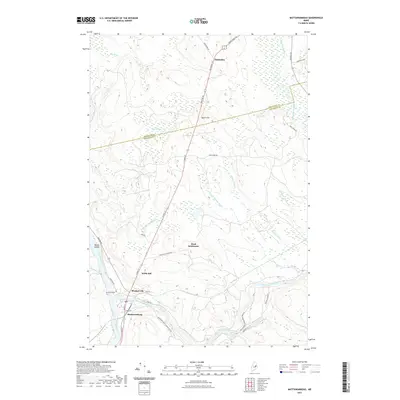
2021 Map of Mattawamkeag
USGS Topo · Published 2021About this map
The Mattawamkeag River and the Penobscot River converge at the village of Mattawamkeag, a historic hub defined by its location at the intersection of these major waterways. This 2021 survey details the surrounding Maine backcountry, where smaller pockets of habitation like Meadowville and the aptly named Back Settlement dot the landscape. To the north, the terrain rises toward Webb Hill and Beech Hill, while the Aroostook Co Penobscot Co boundary line cuts across the forested northern reaches near Molunkus.
Find a feature on this map
42 named features on this map. Tap any name to fly to it.
Don’t see what you’re looking for? This feature index may not catch every label — zoom into the map to look around manually.
Map Details
Editions of this 2021 Mattawamkeag Map
This is the sole edition of this map. No revisions or reprints were ever made.
Other maps of this area

1920 · Winn
USGS Topo · 1:62,500

1931 · Springfield
USGS Topo · 1:48,000

1934 · Springfield
USGS Topo · 1:62,500

1940 · Mattawamkeag
USGS Topo · 1:62,500

1941 · Wytopitlock
USGS Topo · 1:62,500

1942 · Mattawamkeag
USGS Topo · 1:62,500

1943 · Wytopitlock
USGS Topo · 1:62,500

1954 · Millinocket
USGS Topo · 1:250,000

1958 · Millinocket
USGS Topo · 1:250,000

1960 · Millinocket
USGS Topo · 1:250,000