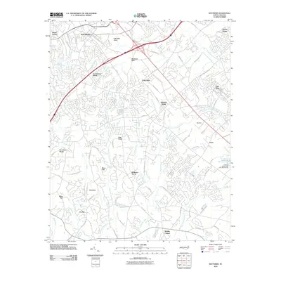
2010 Map of Matthews
USGS Topo · Published 2010About this map
Matthews and Indian Trail anchor this 2010 survey of the expanding suburban corridor southeast of Charlotte. The landscape is defined by the headwaters of several significant drainages, including Twelve Mile Creek and the North Fork Crooked Creek, which carve through a dense network of residential developments such as Club View Acres and Southminster Woods. The transition from rural roots to modern infrastructure is visible in the way major roads like E John St and Stallings Rd connect older settlements like Stouts and Hemby Bridge. Local industry and heritage are preserved in names like Davis Mine Creek and Price Mill Creek, while more recent civic planning is evident in Matthews Park and the specialized engineering of Charlotte Plastics Lake Dam Number Two. The map captures the complex suburban morphology of Stallings as it grew between established municipal centers.
Find a feature on this map
86 named features on this map. Tap any name to fly to it.
Don’t see what you’re looking for? This feature index may not catch every label — zoom into the map to look around manually.
Map Details
Editions of this 2010 Matthews Map
This is the sole edition of this map. No revisions or reprints were ever made.
Other maps of this area

1905 · Charlotte
USGS Topo · 1:48,000

1907 · Charlotte
USGS Topo · 1:62,500

1941 · Charlotte
USGS Topo · 1:125,000

1941 · Spartanburg
USGS Topo · 1:250,000

1942 · Charlotte
USGS Topo · 1:125,000

1948 · Charlotte East
USGS Topo · 1:24,000

1949 · Charlotte East
USGS Topo · 1:24,000

1949 · Wilgrove
USGS Topo · 1:24,000

1949 · Midland
USGS Topo · 1:24,000

1953 · Spartanburg
USGS Topo · 1:250,000