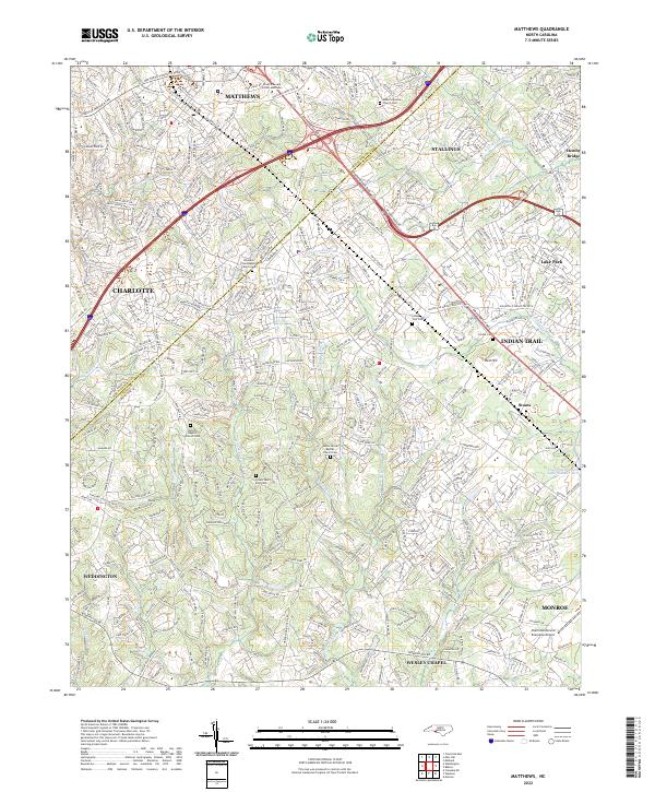
2022 Map of Matthews
USGS Topo · Published 2022About this map
The Mecklenburg Co and Union Co border divides this suburban landscape, where rapid development meets established local landmarks southeast of Charlotte. The historic Seaboard Coast Line RR cuts through the heart of Matthews, anchoring a series of communities including Stallings, Indian Trail, and Weddington. This survey provides a modern snapshot of the region's dense road network and its persistent rural roots, visible in the numerous country churches and cemeteries that have been preserved amidst growing residential tracts.
Find a feature on this map
407 named features on this map. Tap any name to fly to it.
Don’t see what you’re looking for? This feature index may not catch every label — zoom into the map to look around manually.
Map Details
Editions of this 2022 Matthews Map
This is the sole edition of this map. No revisions or reprints were ever made.
Other maps of this area

1905 · Charlotte
USGS Topo · 1:48,000

1907 · Charlotte
USGS Topo · 1:62,500

1941 · Charlotte
USGS Topo · 1:125,000

1941 · Spartanburg
USGS Topo · 1:250,000

1942 · Charlotte
USGS Topo · 1:125,000

1948 · Charlotte East
USGS Topo · 1:24,000

1949 · Charlotte East
USGS Topo · 1:24,000

1949 · Wilgrove
USGS Topo · 1:24,000

1949 · Midland
USGS Topo · 1:24,000

1953 · Spartanburg
USGS Topo · 1:250,000