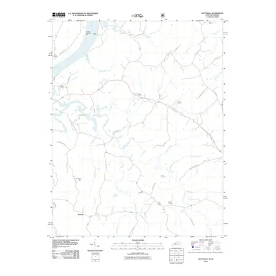
2010 Map of Mattingly
USGS Topo · Published 2010About this map
Clover Creek and its many tributaries, including Hites Run and Beech Fork, carve a complex drainage pattern through this portion of Breckinridge County. The small settlement of Mattingly anchors the southern landscape, while Carter Landing sits at the northern edge along the Ohio River, near the Carters Landing Bar. This area is particularly rich in family burial sites and historical landmarks, such as Iron Ore Hill and a dense concentration of cemeteries including Calvary Cemetery, Hawkins Cemetery, and Pate Cemetery. The road network, featuring names like Old Hardinsburg Rd and Tauls Shop Rd, reflects a long-established rural infrastructure where local commerce once followed these winding routes between river landings and interior farms.
Find a feature on this map
47 named features on this map. Tap any name to fly to it.
Don’t see what you’re looking for? This feature index may not catch every label — zoom into the map to look around manually.
Map Details
Editions of this 2010 Mattingly Map
This is the sole edition of this map. No revisions or reprints were ever made.
Other maps of this area

1928 · Hardinsburg
USGS Topo · 1:48,000

1931 · Hardinsburg
USGS Topo · 1:62,500

1932 · Fordsville
USGS Topo · 1:62,500

1934 · Cannelton
USGS Topo · 1:62,500

1947 · Lodiburg
USGS Topo · 1:24,000

1947 · Hardinsburg
USGS Topo · 1:24,000

1947 · Hardinsburg
USGS Topo · 1:62,500

1949 · Cannelton
USGS Topo · 1:24,000

1953 · Cannelton
USGS Topo · 1:24,000

1953 · Hardinsburg
USGS Topo · 1:24,000