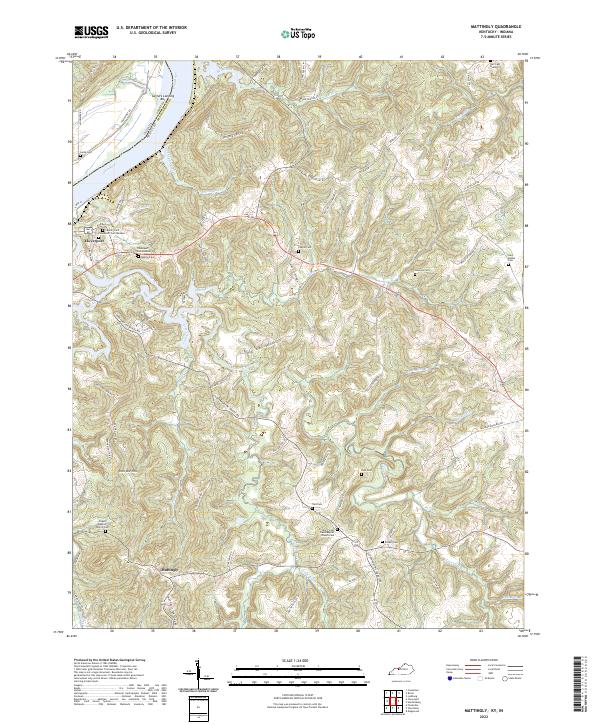
2022 Map of Mattingly
USGS Topo · Published 2022About this map
Cloverport and the surrounding river bluffs define the northwestern corner of this territory, where the Ohio River forms the border between Kentucky and Indiana. The landscape is dominated by a dense network of creek valleys, including Clover Creek and Goehagan Creek, which carve through the plateau toward the river. Historical land use is evident in the numerous small family and community burial grounds found along the ridgelines, such as Chapin Cemetery and Hawkins Cemetery.
Find a feature on this map
85 named features on this map. Tap any name to fly to it.
Don’t see what you’re looking for? This feature index may not catch every label — zoom into the map to look around manually.
Map Details
Editions of this 2022 Mattingly Map
This is the sole edition of this map. No revisions or reprints were ever made.
Other maps of this area

1928 · Hardinsburg
USGS Topo · 1:48,000

1931 · Hardinsburg
USGS Topo · 1:62,500

1932 · Fordsville
USGS Topo · 1:62,500

1934 · Cannelton
USGS Topo · 1:62,500

1947 · Lodiburg
USGS Topo · 1:24,000

1947 · Hardinsburg
USGS Topo · 1:24,000

1947 · Hardinsburg
USGS Topo · 1:62,500

1949 · Cannelton
USGS Topo · 1:24,000

1953 · Cannelton
USGS Topo · 1:24,000

1953 · Hardinsburg
USGS Topo · 1:24,000