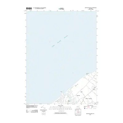
2010 Map of Mattituck Hills
USGS Topo · Published 2010About this map
Mattituck Inlet serves as the primary maritime gateway for this section of the North Fork, where the Mattituck Hills meet the waters of Long Island Sound. The coastline is defined by the entrance to Mattituck Creek and the navigation aid at Mattituck Light, anchoring a landscape that transitions from sandy bluffs at Duck Pond Point to the residential enclaves of Shore Acres and Waterville. The interior highlights the region's agricultural shift toward viticulture, with several established estates including Sherwood House Vineyards, Castello Di Borghese Vineyards, and Pellegrini Vineyards. A network of rural lanes like Soundview Ave and Oregon Rd connects these estates across the Oregon Hills, revealing a mix of established shorefront properties and sprawling North Fork acreage.
Find a feature on this map
23 named features on this map. Tap any name to fly to it.
Don’t see what you’re looking for? This feature index may not catch every label — zoom into the map to look around manually.
Map Details
Editions of this 2010 Mattituck Hills Map
This is the sole edition of this map. No revisions or reprints were ever made.
Other maps of this area

1903 · Sag Harbor
USGS Topo · 1:62,500

1903 · Riverhead
USGS Topo · 1:62,500

1904 · Sag Harbor
USGS Topo · 1:62,500

1904 · Shelter Island
USGS Topo · 1:62,500

1904 · Riverhead
USGS Topo · 1:62,500

1943 · Riverhead
USGS Topo · 1:62,500

1947 · Mattituck
USGS Topo · 1:24,000

1947 · Mattituck Hills
USGS Topo · 1:24,000

1947 · Southold
USGS Topo · 1:24,000

1947 · Southampton
USGS Topo · 1:24,000