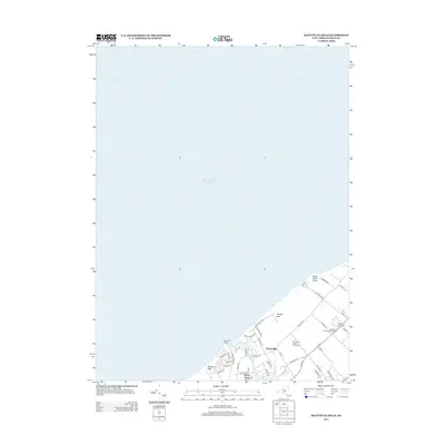
2013 Map of Mattituck Hills
USGS Topo · Published 2013About this map
Mattituck Hills and the surrounding north shore of Long Island are defined by a mix of residential clusters and a developing viticulture landscape. This 2013 survey shows the evolution of land use in the area, where established settlements like Waterville and Shore Acres sit alongside prominent agricultural sites including Sherwood House Vineyards and Pellegrini Vineyards. The coastline is marked by the Mattituck Light and the natural projection of Duck Pond Point, while inland features like Wolf Pit Lake punctuate the terrain. The road network, including Co Rte 48 and Oregon Rd, reflects the modern transportation arteries connecting these North Fork communities. Smaller neighborhoods like Oregon Hills and coastal access points such as Bailie Beach Rd illustrate the local residential character during this period.
Find a feature on this map
48 named features on this map. Tap any name to fly to it.
Don’t see what you’re looking for? This feature index may not catch every label — zoom into the map to look around manually.
Map Details
Editions of this 2013 Mattituck Hills Map
This is the sole edition of this map. No revisions or reprints were ever made.
Other maps of this area

1903 · Sag Harbor
USGS Topo · 1:62,500

1903 · Riverhead
USGS Topo · 1:62,500

1904 · Sag Harbor
USGS Topo · 1:62,500

1904 · Shelter Island
USGS Topo · 1:62,500

1904 · Riverhead
USGS Topo · 1:62,500

1943 · Riverhead
USGS Topo · 1:62,500

1947 · Mattituck
USGS Topo · 1:24,000

1947 · Mattituck Hills
USGS Topo · 1:24,000

1947 · Southold
USGS Topo · 1:24,000

1947 · Southampton
USGS Topo · 1:24,000