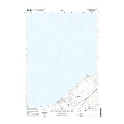
2016 Map of Mattituck Hills
USGS Topo · Published 2016About this map
Mattituck Hills and Oregon Hills define the North Fork shoreline of Long Island in this coastal survey. The landscape transitions from the open waters of the Long Island Sound to a densely mapped network of local roads and residential settlements. The unique geography of the Mattituck Inlet provides a natural harbor leading into Mattituck Creek and Long Creek, which separate the communities of Shore Acres and Mattituck. To the east, the map details the transition into Waterville and Cutchogue, where long-established routes like Middle Rd and Co Rd 48 cut through the interior. Notable local water features like Wolf Pit Lake and the coastal marker at Duck Pond Point provide specific points of reference for those studying the modern topography of this maritime region.
Find a feature on this map
41 named features on this map. Tap any name to fly to it.
Don’t see what you’re looking for? This feature index may not catch every label — zoom into the map to look around manually.
Map Details
Editions of this 2016 Mattituck Hills Map
This is the sole edition of this map. No revisions or reprints were ever made.
Other maps of this area

1903 · Sag Harbor
USGS Topo · 1:62,500

1903 · Riverhead
USGS Topo · 1:62,500

1904 · Sag Harbor
USGS Topo · 1:62,500

1904 · Shelter Island
USGS Topo · 1:62,500

1904 · Riverhead
USGS Topo · 1:62,500

1943 · Riverhead
USGS Topo · 1:62,500

1947 · Mattituck
USGS Topo · 1:24,000

1947 · Mattituck Hills
USGS Topo · 1:24,000

1947 · Southold
USGS Topo · 1:24,000

1947 · Southampton
USGS Topo · 1:24,000