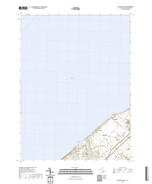
2023 Map of Mattituck Hills
USGS Topo · Published 2023About this map
Long Island Sound borders the northern reaches of the North Fork in this recent survey, where the elevation rises into the Mattituck Hills and Oregon Hills. The geography here is defined by the narrow tidal gateway of the Mattituck Inlet, which snakes inland as Mattituck Creek to separate the residential clusters of Shore Acres and Waterville. Unlike the more developed areas to the south, this coastline maintains a series of points and inlets, including Duck Pond Point, that have shaped the local maritime character for generations.
Find a feature on this map
44 named features on this map. Tap any name to fly to it.
Don’t see what you’re looking for? This feature index may not catch every label — zoom into the map to look around manually.
Map Details
Editions of this 2023 Mattituck Hills Map
This is the sole edition of this map. No revisions or reprints were ever made.
Other maps of this area

1903 · Sag Harbor
USGS Topo · 1:62,500

1903 · Riverhead
USGS Topo · 1:62,500

1904 · Sag Harbor
USGS Topo · 1:62,500

1904 · Shelter Island
USGS Topo · 1:62,500

1904 · Riverhead
USGS Topo · 1:62,500

1943 · Riverhead
USGS Topo · 1:62,500

1947 · Mattituck
USGS Topo · 1:24,000

1947 · Mattituck Hills
USGS Topo · 1:24,000

1947 · Southold
USGS Topo · 1:24,000

1947 · Southampton
USGS Topo · 1:24,000