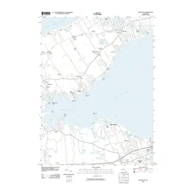
2010 Map of Mattituck
USGS Topo · Published 2010About this map
Mattituck and the surrounding North Fork agricultural landscape define this coastal survey, where historic vineyards and museum farms meet the waters of Great Peconic Bay. The map documents a deeply rooted rural economy, naming numerous active agricultural sites such as Hallockville Museum Farm, Crescent Duck Farm, and the Golden Earthworm Organic Farm. This agrarian character is mirrored by the density of family-named landmarks and local vineyards including Paumanok Vineyards and Martha Clara Vineyards.
Find a feature on this map
114 named features on this map. Tap any name to fly to it.
Don’t see what you’re looking for? This feature index may not catch every label — zoom into the map to look around manually.
Map Details
Editions of this 2010 Mattituck Map
This is the sole edition of this map. No revisions or reprints were ever made.
Other maps of this area

1903 · Sag Harbor
USGS Topo · 1:62,500

1903 · Riverhead
USGS Topo · 1:62,500

1904 · Sag Harbor
USGS Topo · 1:62,500

1904 · Shelter Island
USGS Topo · 1:62,500

1904 · Riverhead
USGS Topo · 1:62,500

1943 · Riverhead
USGS Topo · 1:62,500

1947 · Mattituck
USGS Topo · 1:24,000

1947 · Mattituck Hills
USGS Topo · 1:24,000

1947 · Southold
USGS Topo · 1:24,000

1947 · Southampton
USGS Topo · 1:24,000