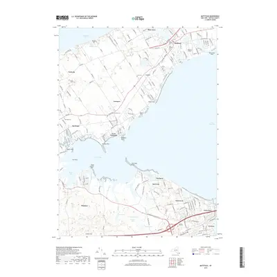
2019 Map of Mattituck
USGS Topo · Published 2019About this map
Great Peconic Bay and Flanders Bay divide this portion of the North and South Forks, where a network of inlets and ponds defines the coastal geography. The landscape transitions from the dense agricultural and residential corridors of Northville, Aquebogue, and Mattituck in the north to the tidal marshes and swamps surrounding Flanders and Squiretown in the south. This late-2010s survey captures the region's historic identity through its numerous cemeteries, such as Sound Avenue Cem and Jamesport Cem, which reflect generations of family settlements along the primary arteries of Sound Ave and Main Rd.
Find a feature on this map
59 named features on this map. Tap any name to fly to it.
Don’t see what you’re looking for? This feature index may not catch every label — zoom into the map to look around manually.
Map Details
Editions of this 2019 Mattituck Map
This is the sole edition of this map. No revisions or reprints were ever made.
Other maps of this area

1903 · Sag Harbor
USGS Topo · 1:62,500

1903 · Riverhead
USGS Topo · 1:62,500

1904 · Sag Harbor
USGS Topo · 1:62,500

1904 · Shelter Island
USGS Topo · 1:62,500

1904 · Riverhead
USGS Topo · 1:62,500

1943 · Riverhead
USGS Topo · 1:62,500

1947 · Mattituck
USGS Topo · 1:24,000

1947 · Mattituck Hills
USGS Topo · 1:24,000

1947 · Southold
USGS Topo · 1:24,000

1947 · Southampton
USGS Topo · 1:24,000