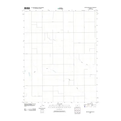
2010 Map of Mattox Draw NW
USGS Topo · Published 2010About this map
Mattox Draw and James Draw define the drainage of this agricultural landscape in Kearny County, Kansas. The map depicts a sparse, high-plains environment organized around a rigid section-line road network, including thoroughfares such as Co Rd 2 and Co Rd 10. This topography illustrates the persistent influence of the Public Land Survey System on modern infrastructure, where travel and property boundaries remain tied to the original township and range grid. Small water bodies and ephemeral draws are scattered across the terrain, providing the primary relief in an otherwise flat expanse of rural western Kansas. This survey shows the area just after the first decade of the 21st century, as rural road systems like Co Rd H and Co Rd J continued to serve the vast grazing and farming tracts of the region.
Find a feature on this map
14 named features on this map. Tap any name to fly to it.
Don’t see what you’re looking for? This feature index may not catch every label — zoom into the map to look around manually.
Map Details
Editions of this 2010 Mattox Draw NW Map
This is the sole edition of this map. No revisions or reprints were ever made.
Other maps of this area

1955 · Scott City
USGS Topo · 1:250,000

1958 · Scott City
USGS Topo · 1:250,000

1965 · Leoti 3 NW
USGS Topo · 1:24,000

1965 · Leoti 3 NE
USGS Topo · 1:24,000
1966 · Leoti 3 SW
USGS Topo · 1:24,000
1966 · Tribune 4 SE
USGS Topo · 1:24,000

1966 · Tribune 4 NE
USGS Topo · 1:24,000
1966 · Leoti 3 SE
USGS Topo · 1:24,000

1970 · Selkirk SE
USGS Topo · 1:24,000

1970 · Lydia
USGS Topo · 1:24,000