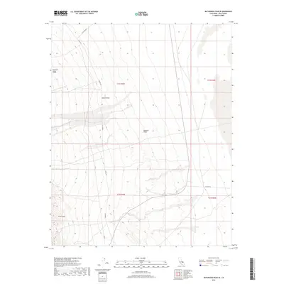
2018 Map of Maturango Peak SE
USGS Topo · Published 2018About this map
Panamint Valley Crater and the stark geology of the Argus Range dominate this 2018 study of Inyo County. The landscape is defined by the alluvial fans and arid basins of the Mojave Desert, where the Panamint Valley floor meets the rising mountain slopes. Human presence is marked by a sparse network of desert routes, including the long stretch of Nadeau Rd and Slate Range Rd. These roads often follow the natural contours of the valley, providing access to this remote interior of California where geological features far outnumber settlements. The map highlights the intersection of Ballarat Rd, offering a detailed view of the terrain before it reaches more established outposts in the surrounding desert.
Find a feature on this map
11 named features on this map. Tap any name to fly to it.
Don’t see what you’re looking for? This feature index may not catch every label — zoom into the map to look around manually.
Map Details
Editions of this 2018 Maturango Peak SE Map
This is the sole edition of this map. No revisions or reprints were ever made.
Other maps of this area

1908 · Ballarat
USGS Topo · 1:250,000

1913 · Ballarat
USGS Topo · 1:250,000

1915 · Searles Lake
USGS Topo · 1:250,000

1947 · Trona
USGS Topo · 1:250,000

1948 · Trona
USGS Topo · 1:250,000

1948 · Death Valley
USGS Topo · 1:250,000

1949 · Trona
USGS Topo · 1:62,500

1950 · Trona
USGS Topo · 1:62,500

1950 · Manly Peak
USGS Topo · 1:62,500
1951 · Manly Peak
USGS Topo · 1:62,500