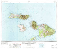
1974 Map of Maui
USGS Topo · Published 1974About this map
Maui, Molokai, Lanai, and Kahoolawe appear together in this mid-century compilation, capturing the central Hawaiian islands as they transitioned into a modern era of tourism and conservation. The landscape is defined by vast protected areas, including Haleakala National Park and numerous forest reserves like the West Maui Forest Reserve. Along the coasts, established settlements like Lahaina, Wailuku, and Kahului serve as primary hubs, while the isolated Kalaupapa peninsula on northern Molokai remains a distinct point of interest marked by its lighthouse.
Find a feature on this map
72 named features on this map. Tap any name to fly to it.
Don’t see what you’re looking for? This feature index may not catch every label — zoom into the map to look around manually.
Map Details
Editions of this 1974 Maui Map
2 editions found

Other maps of this area

1923 · Island of Lanai
USGS Topo · 1:31,680

1925 · Island of Lanai
USGS Topo · 1:62,500

1929 · Kahoolawe
USGS Topo · 1:62,500

1952 · Halawa
USGS Topo · 1:24,000

1952 · Molokai Airport
USGS Topo · 1:24,000

1952 · Kamalo
USGS Topo · 1:24,000
1952 · Ilio Point
USGS Topo · 1:24,000

1952 · Kaunakakai
USGS Topo · 1:24,000

1954 · Oahu
USGS Topo · 1:250,000

1954 · Maui
USGS Topo · 1:250,000