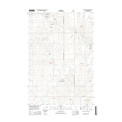
2014 Map of Maukey Gulch
USGS Topo · Published 2014About this map
Deerlodge National Forest encompasses this high-elevation terrain in Granite County, where a complex network of drainages defines the local geography. The landscape is marked by steep ravines such as Big Moffat Gulch, Sapphire Gulch, and Schoolmarm Gulch, which feed into major waterways like Rock Creek and its many branches. Water management and natural reservoirs are evident through features like Stephens Reservoir and Milo Lake, providing critical resources in this forested region.
Find a feature on this map
40 named features on this map. Tap any name to fly to it.
Don’t see what you’re looking for? This feature index may not catch every label — zoom into the map to look around manually.
Map Details
Editions of this 2014 Maukey Gulch Map
This is the sole edition of this map. No revisions or reprints were ever made.
Other maps of this area

1908 · Philipsburg
USGS Topo · 1:125,000

1909 · Sapphire
USGS Topo · 1:125,000

1947 · Butte
USGS Topo · 1:250,000

1958 · Butte
USGS Topo · 1:250,000

1960 · Butte
USGS Topo · 1:250,000

1962 · Butte
USGS Topo · 1:250,000

1971 · Antelope Creek
USGS Topo · 1:24,000

1971 · Potato Lakes
USGS Topo · 1:24,000
1971 · Carpp Ridge
USGS Topo · 1:24,000

1971 · Stony Creek
USGS Topo · 1:24,000