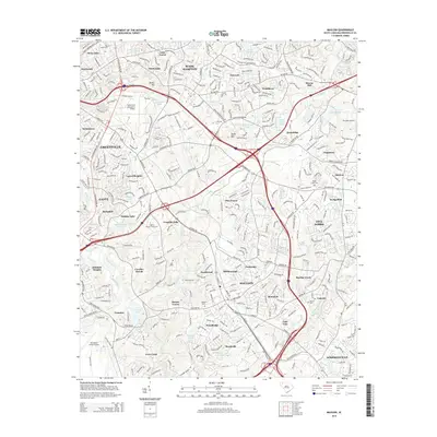
2014 Map of Mauldin
USGS Topo · Published 2014About this map
The Mauldin and Greenville area is defined by a dense intersection of interstate commerce and suburban expansion, where the confluence of I-85, I-385, and I-185 shapes the modern landscape. Aviation history is prominent on this sheet, featuring three distinct facilities: the Greenville Downtown Airport, Donaldson Center Airport, and the private Hartness Airport to the east. These transportation hubs surround long-standing neighborhoods like Wade Hampton, Nicholtown, and Gantt.
Find a feature on this map
86 named features on this map. Tap any name to fly to it.
Don’t see what you’re looking for? This feature index may not catch every label — zoom into the map to look around manually.
Map Details
Editions of this 2014 Mauldin Map
This is the sole edition of this map. No revisions or reprints were ever made.
Other maps of this area

1935 · Greer
USGS Topo · 1:48,000

1935 · Greenville
USGS Topo · 1:48,000

1938 · Greenville
USGS Topo · 1:62,500

1938 · Greer
USGS Topo · 1:62,500

1954 · Greenville
USGS Topo · 1:250,000

1957 · Fountain Inn
USGS Topo · 1:62,500

1957 · Greenville
USGS Topo · 1:24,000

1957 · Williamston
USGS Topo · 1:62,500

1957 · Greer
USGS Topo · 1:62,500

1957 · Greenville
USGS Topo · 1:62,500