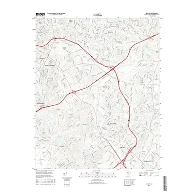
2017 Map of Mauldin
USGS Topo · Published 2017About this map
Mauldin and the southeastern outskirts of Greenville dominate this 2017 topographic survey, illustrating the modern expansion of these Upstate South Carolina communities. The landscape is defined by a dense network of residential developments and industrial corridors, yet significant local history is preserved in sites like Mauldin Cem and the Bethel Cem. Major transportation and aviation hubs are prominent, including the Greenville Downtown Airport and Donaldson Field, reflecting the region's industrial strength. The terrain features notable elevations like Roper Mtn and Butler Hill, which overlook the complex drainage systems of the Reedy River and Gilder Cr. Numerous smaller bodies of water, such as Oak Grove Lake, McCalls Lake, and Conestee Lake, are integrated into the suburban fabric, serving as focal points for the surrounding neighborhoods of Conestee, Simpsonville, and Gantt.
Find a feature on this map
395 named features on this map. Tap any name to fly to it.
Don’t see what you’re looking for? This feature index may not catch every label — zoom into the map to look around manually.
Map Details
Editions of this 2017 Mauldin Map
This is the sole edition of this map. No revisions or reprints were ever made.
Other maps of this area

1935 · Greer
USGS Topo · 1:48,000

1935 · Greenville
USGS Topo · 1:48,000

1938 · Greenville
USGS Topo · 1:62,500

1938 · Greer
USGS Topo · 1:62,500

1954 · Greenville
USGS Topo · 1:250,000

1957 · Fountain Inn
USGS Topo · 1:62,500

1957 · Greenville
USGS Topo · 1:24,000

1957 · Williamston
USGS Topo · 1:62,500

1957 · Greer
USGS Topo · 1:62,500

1957 · Greenville
USGS Topo · 1:62,500