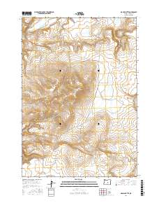
2017 Map of Maupin Butte
USGS Topo · Published 2017About this map
Maupin Butte dominates this high-desert portion of Crook County, where the landscape is defined by elevated mesas and seasonal drainage channels. The 2017 survey reveals a remote topography centered on the volcanic formations of Milk Butte and Homestead Butte. Water sources are sparse but critical to the area's geography, represented by the winding Alkali Cr and the localized Maupin Spring. Large plateau features like Twelvemile Table and Ryegrass Table suggest a region utilized for grazing, while the inclusion of the Summit Reservoir indicates efforts to manage water in this arid environment. The map provides a clear view of the complex terrain of Payne Ridge and Odell Hollow, as well as the headwaters of Beaver Creek in the northwest.
Find a feature on this map
15 named features on this map. Tap any name to fly to it.
Don’t see what you’re looking for? This feature index may not catch every label — zoom into the map to look around manually.
Map Details
Editions of this 2017 Maupin Butte Map
This is the sole edition of this map. No revisions or reprints were ever made.
Other maps of this area

1932 · Dayville
USGS Topo · 1:125,000

1936 · Dayville
USGS Topo · 1:125,000

1955 · Crescent
USGS Topo · 1:250,000

1955 · Bend
USGS Topo · 1:250,000

1955 · Burns
USGS Topo · 1:250,000

1955 · Canyon City
USGS Topo · 1:250,000

1957 · Crescent
USGS Topo · 1:250,000

1957 · Bend
USGS Topo · 1:250,000

1958 · Crescent
USGS Topo · 1:250,000

1958 · Burns
USGS Topo · 1:250,000