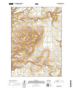
2020 Map of Maupin Butte
USGS Topo · Published 2020About this map
Maupin Butte and the surrounding high-desert plateaus of Crook County define this landscape of the American West. The terrain is characterized by massive, flat-topped formations like Twelvemile Table and Ryegrass Table, which rise above the drainages of Beaver Creek and the seasonally intermittent Alkali Cr. These features reflect a history of cattle grazing and open-range ranching that has persisted for generations in this part of Oregon.
Find a feature on this map
15 named features on this map. Tap any name to fly to it.
Don’t see what you’re looking for? This feature index may not catch every label — zoom into the map to look around manually.
Map Details
Editions of this 2020 Maupin Butte Map
This is the sole edition of this map. No revisions or reprints were ever made.
Other maps of this area

1932 · Dayville
USGS Topo · 1:125,000

1936 · Dayville
USGS Topo · 1:125,000

1955 · Crescent
USGS Topo · 1:250,000

1955 · Bend
USGS Topo · 1:250,000

1955 · Burns
USGS Topo · 1:250,000

1955 · Canyon City
USGS Topo · 1:250,000

1957 · Crescent
USGS Topo · 1:250,000

1957 · Bend
USGS Topo · 1:250,000

1958 · Crescent
USGS Topo · 1:250,000

1958 · Burns
USGS Topo · 1:250,000