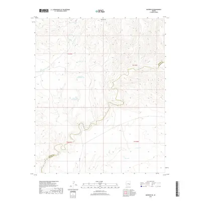
2018 Map of Maverick SW
USGS Topo · Published 2018About this map
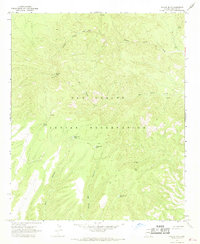
Black River snakes through the southern portion of this high-altitude landscape, carving a deep canyon along the border between Apache and Graham counties. Dominating the northern horizon, Maverick Mtn rises above a network of seasonal watercourses and drainage systems including Ten of Diamonds Cr, Paddy Cr, and Dry Cr. This 2018 survey reveals a terrain managed for water resources in an arid environment, evidenced by numerous named tanks such as Whirley Basin Tank Number One, Whirley Basin Tank Number Two, and P S Spring Tank. The map illustrates how natural features like Burnt Corral Spring and Mud Spring are supplemented by man-made catchments like Bee Tank, highlighting the critical importance of water management in this remote section of the Arizona wilderness.
Find a feature on this map
22 named features on this map. Tap any name to fly to it.
Don’t see what you’re looking for? This feature index may not catch every label — zoom into the map to look around manually.
Map Details
Editions of this 2018 Maverick SW Map
This is the sole edition of this map. No revisions or reprints were ever made.
Other maps of this area

1954 · Clifton
USGS Topo · 1:250,000

1957 · Clifton
USGS Topo · 1:250,000

1958 · Clifton
USGS Topo · 1:250,000

1962 · Clifton
USGS Topo · 1:250,000

1967 · Freezeout Mountain
USGS Topo · 1:24,000
1967 · Sawbuck Mtn.
USGS Topo · 1:24,000
1967 · Maverick SW
USGS Topo · 1:24,000
1967 · West Poker Mtn.
USGS Topo · 1:24,000

1967 · Odart Mtn
USGS Topo · 1:24,000
1967 · Willow Mtn.
USGS Topo · 1:24,000