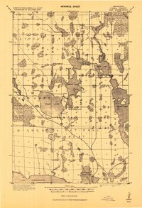
1919 Map of Max
USGS Topo · Published 1943About this map
Minnesota National Forest lands dominate the southern half of this region during the early twentieth century, reflecting the early conservation efforts in Itasca County. The landscape is defined by its extensive water systems, from the northern flow of the Big Fork River out of Dora Lake to the sprawling northern reaches of Lake Winnibigoshish at the southern boundary. This era shows a scattered network of small settlements and post offices such as Max, Popple, Orchid, and Dunbar, each serving as local hubs for timber and homesteading families. The mapping of the 12th Standard Parallel North provides a clear view of the formal township surveying that preceded more intensive development. Isolated schools are marked throughout the townships of Alwood, Kinghurst, and Good Hope, illustrating the rural infrastructure supporting these early northern Minnesota communities.
Find a feature on this map
25 named features on this map. Tap any name to fly to it.
Don’t see what you’re looking for? This feature index may not catch every label — zoom into the map to look around manually.
Map Details
Editions of this 1919 Max Map
2 editions found
Other maps of this area

1918 · Zora
USGS Topo · 1:62,500

1919 · Rosy
USGS Topo · 1:62,500

1919 · Zora
USGS Topo · 1:62,500

1919 · Gemmell
USGS Topo · 1:62,500

1919 · Max
USGS Topo · 1:62,500

1919 · Bridgie
USGS Topo · 1:62,500

1924 · Bridgie
USGS Topo · 1:62,500

1954 · Bemidji
USGS Topo · 1:250,000

1954 · Hibbing
USGS Topo · 1:250,000

1957 · Bemidji
USGS Topo · 1:250,000