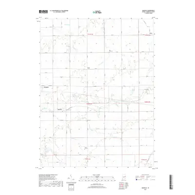
2019 Map of Maxville
USGS Topo · Published 2019About this map
Farmland and Maxville anchor this part of Randolph County, where the White River winds through the rural Indiana landscape. The area is defined by a grid of agricultural roads and a network of waterways, including Eightmile Cr, Sparrow Cr, and Bush Cr, which supported the early development of these small farming communities. Interpretive details reveal a high concentration of burial grounds such as Bear Creek Cem and Woodlawn Cem, which provide critical touchstones for local genealogical research. Smaller crossroads like Mull and Stone appear as quiet points along the section lines, while several drainage projects like Denton Ditch and Stevens Ditch reflect the historical engineering required to manage the flat, productive farmland of central Indiana in the late twenty-first century.
Find a feature on this map
44 named features on this map. Tap any name to fly to it.
Don’t see what you’re looking for? This feature index may not catch every label — zoom into the map to look around manually.
Map Details
Editions of this 2019 Maxville Map
This is the sole edition of this map. No revisions or reprints were ever made.
Other maps of this area

1915 · Fort Recovery
USGS Topo · 1:48,000

1916 · Winchester
USGS Topo · 1:48,000

1918 · Winchester
USGS Topo · 1:62,500

1918 · Fort Recovery
USGS Topo · 1:62,500

1943 · Winchester
USGS Topo · 1:62,500

1952 · Maxville
USGS Topo · 1:24,000

1952 · Farmland
USGS Topo · 1:24,000

1953 · Muncie
USGS Topo · 1:250,000

1956 · Muncie
USGS Topo · 1:250,000

1960 · Carlos
USGS Topo · 1:24,000