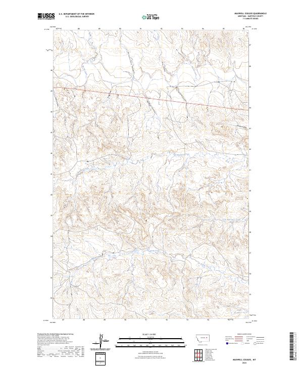
2024 Map of Maxwell Coulee
USGS Topo · Published 2024About this map
Maxwell Coulee defines the drainage patterns of this high plains landscape in Garfield County, where a network of seasonal watercourses and deep draws carve through the township sections. The northern reaches are shaped by Big Dry Creek and Nannestead Coulee, while the central terrain is marked by the distinctively named Carcass Coulee and Tree Coulee. This 2024 survey documents the enduring ranching and public land survey system (PLSS) divisions of north-central Montana, revealing how the geography is organized around drainages like Wild Horse Creek and Little Wild Horse Creek. The presence of numerous named coulees, including Peden Coulee and Bridge Coulee, indicates a highly dissected plateau where water management and natural boundaries remain essential to the local identity and land use.
Find a feature on this map
18 named features on this map. Tap any name to fly to it.
Don’t see what you’re looking for? This feature index may not catch every label — zoom into the map to look around manually.
Map Details
Editions of this 2024 Maxwell Coulee Map
This is the sole edition of this map. No revisions or reprints were ever made.
Other maps of this area

1954 · Jordan
USGS Topo · 1:250,000

1956 · Jordan
USGS Topo · 1:250,000

1958 · Jordan
USGS Topo · 1:250,000

1964 · Jordan
USGS Topo · 1:250,000

1964 · Ada Creek
USGS Topo · 1:24,000

1964 · Bateman Coulee NE
USGS Topo · 1:24,000

1965 · Whiteside Ranch
USGS Topo · 1:24,000

1965 · Hafla School
USGS Topo · 1:24,000
1965 · Cohagen NE
USGS Topo · 1:24,000

1967 · Hagen Gap
USGS Topo · 1:24,000