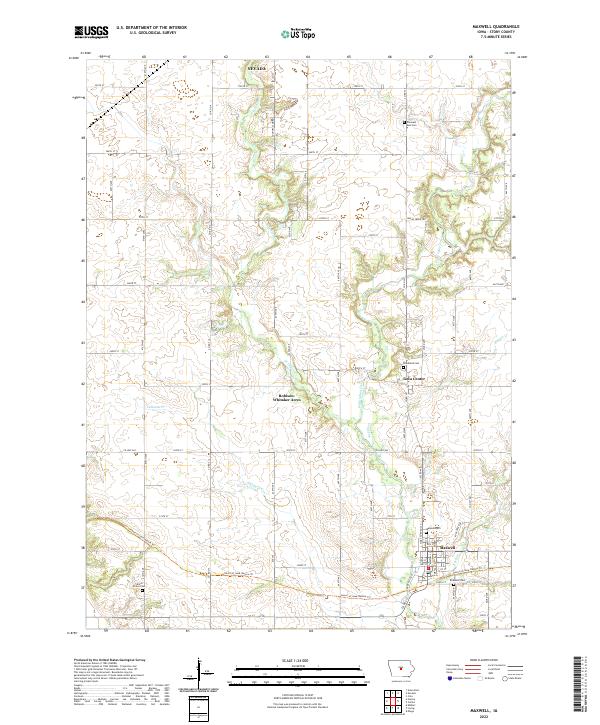
2022 Map of Maxwell
USGS Topo · Published 2022About this map
Maxwell sits at the heart of this Story County landscape, where the agricultural grid is softened by the meandering course of East Indian Creek and its various tributaries. The town serves as a focal point for the surrounding rural area, which includes the smaller settlement of Iowa Center to the north and the residential pocket of Robison-Whitaker Acres. The topography is defined by the drainage basins of W Indian Cr, Rupple Cr, and Calamus Cr, creating a pattern of creekside vegetation and variable terrain that breaks up the expansive farm fields. For those researching local history, several burial grounds are preserved across the sections, including Maxwell Cem, Woodland Cem, and Pleasant Run Cem. The map also traces modern recreational developments such as the Indian Creek Trl, which follows the waterways that have historically dictated the placement of homesteads and roads in this part of central Iowa.
Find a feature on this map
60 named features on this map. Tap any name to fly to it.
Don’t see what you’re looking for? This feature index may not catch every label — zoom into the map to look around manually.
Map Details
Editions of this 2022 Maxwell Map
This is the sole edition of this map. No revisions or reprints were ever made.
Other maps of this area

1911 · Slater
USGS Topo · 1:62,500

1912 · Ames
USGS Topo · 1:62,500

1913 · Slater
USGS Topo · 1:62,500

1914 · Ames
USGS Topo · 1:62,500

1954 · Waterloo
USGS Topo · 1:250,000

1954 · Des Moines
USGS Topo · 1:250,000

1955 · Waterloo
USGS Topo · 1:250,000

1956 · Des Moines
USGS Topo · 1:250,000

1957 · Des Moines
USGS Topo · 1:250,000

1969 · Des Moines
USGS Topo · 1:250,000