
1982 Map of May Lake
USGS Topo · Published 1983About this map
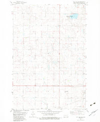
Danzig Cem stands as a quiet focal point in this southern section of McIntosh County, signifying the rural heritage of the prairie during the early 1980s. The landscape is characterized by its agricultural organization, marked by numerous wells and defined by the Corporate Boundary of a nearby municipality. Transport and infrastructure are represented by the Soo Line railroad, which cuts a straight path across the northern reaches, and the Municipal Airport situated just north of the corporate limits. This survey illustrates a period of established land use, where the glacial depressions of the Missouri Plateau are filled by water bodies like May Lake. The presence of several Gravel Pits indicates the local extractive industry that supported the region's road and construction needs.
Find a feature on this map
7 named features on this map. Tap any name to fly to it.
Don’t see what you’re looking for? This feature index may not catch every label — zoom into the map to look around manually.
Map Details
Editions of this 1982 May Lake Map
This is the sole edition of this map. No revisions or reprints were ever made.
Other maps of this area

1953 · Jamestown
USGS Topo · 1:250,000

1956 · Jamestown
USGS Topo · 1:250,000

1982 · Wishek SW
USGS Topo · 1:24,000

1982 · Danzig
USGS Topo · 1:24,000

1982 · May Lake NW
USGS Topo · 1:24,000

1982 · May Lake SW
USGS Topo · 1:24,000
1982 · May Lake SE
USGS Topo · 1:24,000

1982 · Lehr SW
USGS Topo · 1:24,000
1982 · Ashley West
USGS Topo · 1:24,000

1982 · Wishek
USGS Topo · 1:24,000