
1982 Map of Wishek SW
USGS Topo · Published 1983About this map
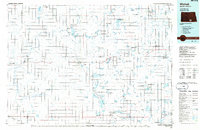
The Starkey township line and the boundary between Logan and McIntosh Counties divide this high plains landscape of south-central North Dakota. The area's settlement history is anchored by the presence of Salems Cem and Worms Cem, marking the heritage of the local rural community. To the northeast, the map shows a portion of Red Lake, while the remainder of the terrain is defined by undulating topography punctuated by isolated wells and a Gravel Pit. The map captures a moment when fence and field lines, identified by fine red dashed markings from aerial photography, still clearly delineated the agricultural organization of the land. This survey reflects the sparse, functional layout of the region in the early 1980s, where land use was focused on farming and natural resource extraction.
Find a feature on this map
9 named features on this map. Tap any name to fly to it.
Don’t see what you’re looking for? This feature index may not catch every label — zoom into the map to look around manually.
Map Details
Editions of this 1982 Wishek SW Map
This is the sole edition of this map. No revisions or reprints were ever made.
Other maps of this area

1953 · Jamestown
USGS Topo · 1:250,000

1956 · Jamestown
USGS Topo · 1:250,000

1979 · Schell Buttes
USGS Topo · 1:24,000

1979 · McKenna Lake South
USGS Topo · 1:24,000

1982 · Wishek NE
USGS Topo · 1:24,000

1982 · May Lake NW
USGS Topo · 1:24,000

1982 · Burnstad
USGS Topo · 1:24,000

1982 · May Lake
USGS Topo · 1:24,000

1982 · Wishek
USGS Topo · 1:24,000
1986 · Wishek
USGS Topo · 1:100,000