
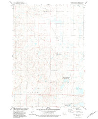
1982 Map of Burnstad
USGS Topo · Published 1983About this map
Burnstad stands as the primary hub in this corner of Logan County, characterized by a vast landscape of pothole lakes and undulating plains. The community is anchored by the St Clares Ch and is connected to the wider region by the Soo Line railroad, which cuts a diagonal path through the prairie. This survey captures the rural infrastructure of the early 1980s, documenting local landmarks like Peters and several Gravel Pits that supported the local road network. Genealogy interests are well-served by the inclusion of the Red Lake Community Cem near Red Lake and the isolated Hoof Cem in the northern reaches of the quadrangle. Drainage for the area is dominated by the winding course of Beaver Creek, which meanders through the townships of Bryant, Dixon, and Starkey.
Find a feature on this map
14 named features on this map. Tap any name to fly to it.
Don’t see what you’re looking for? This feature index may not catch every label — zoom into the map to look around manually.
Map Details
Editions of this 1982 Burnstad Map
This is the sole edition of this map. No revisions or reprints were ever made.
Other maps of this area

1953 · Jamestown
USGS Topo · 1:250,000

1956 · Jamestown
USGS Topo · 1:250,000

1979 · Schell Buttes
USGS Topo · 1:24,000

1979 · McKenna Lake South
USGS Topo · 1:24,000

1980 · McKenna Lake North
USGS Topo · 1:24,000

1982 · Wishek SW
USGS Topo · 1:24,000

1982 · Wishek NE
USGS Topo · 1:24,000

1982 · Wishek
USGS Topo · 1:24,000

1983 · Alkaline Lake SW
USGS Topo · 1:24,000
1983 · Streeter Flats
USGS Topo · 1:24,000