
1979 Map of Schell Buttes
USGS Topo · Published 1980About this map
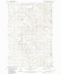
Beaver Creek carves a winding path through this corner of the Missouri Plateau, marking a landscape defined by glacial topography and prairie drainage. The map highlights the localized elevations of the Schell Buttes, which serve as a prominent natural landmark in the southeastern portion of the quadrangle. Human influence on the water table is evident through the construction of the Park Wilkey Dam, while the rural social fabric of the late 1970s is anchored by St Anthonys Cem and the surrounding township of Starkey. Crossing the border from Logan County into McIntosh County, the survey reveals a scattered network of resource extraction sites like the Gravel Pit and numerous wells, reflecting the region's reliance on groundwater and local materials for infrastructure.
Find a feature on this map
8 named features on this map. Tap any name to fly to it.
Don’t see what you’re looking for? This feature index may not catch every label — zoom into the map to look around manually.
Map Details
Editions of this 1979 Schell Buttes Map
This is the sole edition of this map. No revisions or reprints were ever made.
Other maps of this area

1953 · Jamestown
USGS Topo · 1:250,000

1956 · Jamestown
USGS Topo · 1:250,000

1979 · Schell Buttes SW
USGS Topo · 1:24,000

1979 · Schell Buttes NW
USGS Topo · 1:24,000

1979 · McKenna Lake South
USGS Topo · 1:24,000
1980 · Weisser Dam West
USGS Topo · 1:24,000

1982 · Wishek SW
USGS Topo · 1:24,000

1982 · May Lake NW
USGS Topo · 1:24,000

1982 · Burnstad
USGS Topo · 1:24,000
1986 · Wishek
USGS Topo · 1:100,000