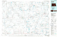
1986 Map of Wishek
USGS Topo · Published 1986About this map
Wishek and Ashley serve as the primary hubs of this prairie landscape, reflecting the agricultural and transportation patterns of south-central North Dakota in the mid-1980s. The region is defined by a dense network of conservation areas, including the Flickertail National Wildlife Refuge and numerous National Waterfowl Production Areas, which occupy the numerous potholes and glacial depressions across the terrain. Two major rail corridors, the Soo Line and Burlington Northern, thread through these small towns, connecting the grain-producing prairies to broader markets.
Find a feature on this map
63 named features on this map. Tap any name to fly to it.
Don’t see what you’re looking for? This feature index may not catch every label — zoom into the map to look around manually.
Map Details
Editions of this 1986 Wishek Map
2 editions found
Other maps of this area

1896 · Jamestown
USGS Topo · 1:125,000

1896 · Edgeley
USGS Topo · 1:125,000

1899 · Ellendale
USGS Topo · 1:125,000

1925 · Edgeley
USGS Topo · 1:125,000

1953 · Jamestown
USGS Topo · 1:250,000

1953 · Jud
USGS Topo · 1:24,000

1953 · McIntosh
USGS Topo · 1:250,000

1954 · Aberdeen
USGS Topo · 1:250,000

1954 · Bismarck
USGS Topo · 1:250,000

1956 · Aberdeen
USGS Topo · 1:250,000