
1982 Map of Wishek NE
USGS Topo · Published 1983About this map
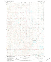
Beaver Lake State Park and the expansive waters of Beaver Lake dominate the southwestern corner of this Logan County landscape. This survey, based on 1970s aerial photography, reveals a glaciated terrain characterized by numerous small prairie potholes and larger water bodies like Island Lake and Doyles Lake. A local landmark, the Old Settlers Monument, stands near the shore of the primary lake, signifying the area's importance to early regional pioneers. The prevalence of the National Waterfowl Production Area underscores the importance of this wetland ecosystem. Within the townships of Dixon and Red Lake, the map documents a sparse agricultural and conservation-focused environment, where Beaver Creek drains the lake and a network of section-line roads connects isolated wells and gravel extraction sites.
Find a feature on this map
12 named features on this map. Tap any name to fly to it.
Don’t see what you’re looking for? This feature index may not catch every label — zoom into the map to look around manually.
Map Details
Editions of this 1982 Wishek NE Map
This is the sole edition of this map. No revisions or reprints were ever made.
Other maps of this area

1953 · Jamestown
USGS Topo · 1:250,000

1956 · Jamestown
USGS Topo · 1:250,000

1982 · Wishek SW
USGS Topo · 1:24,000

1982 · Burnstad
USGS Topo · 1:24,000

1982 · Lehr NW
USGS Topo · 1:24,000

1982 · Lehr SW
USGS Topo · 1:24,000

1982 · Wishek
USGS Topo · 1:24,000

1983 · Streeter SW
USGS Topo · 1:24,000

1983 · Alkaline Lake SW
USGS Topo · 1:24,000
1983 · Streeter Flats
USGS Topo · 1:24,000