
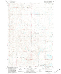
1983 Map of Alkaline Lake SW
USGS Topo · Published 1983About this map
Glacial prairie potholes and countless small depressions define this section of North Dakota, recorded as it appeared in the late 1970s. The landscape is divided among the rural townships of Glendale, Bryant, and Dixon, where section lines and unimproved roads form a rigid grid across the undulating terrain. A solitary Townhall stands in Glendale, while the Salem Cem in the eastern portion of the sheet provides a tangible link to the area's early settlement history. The topography is predominantly characterized by interior drainage, with numerous small water bodies scattered across the townships, reflecting the post-glacial geography of the Missouri Coteau region. This survey captures the sparse, agrarian character of the plains before modern agricultural shifts or development altered the quiet footprint of these rural communities.
Find a feature on this map
9 named features on this map. Tap any name to fly to it.
Don’t see what you’re looking for? This feature index may not catch every label — zoom into the map to look around manually.
Map Details
Editions of this 1983 Alkaline Lake SW Map
This is the sole edition of this map. No revisions or reprints were ever made.
Other maps of this area

1953 · Jamestown
USGS Topo · 1:250,000

1956 · Jamestown
USGS Topo · 1:250,000

1979 · Kintyre NE
USGS Topo · 1:24,000

1979 · McKenna Lake South
USGS Topo · 1:24,000

1980 · McKenna Lake North
USGS Topo · 1:24,000

1982 · Wishek NE
USGS Topo · 1:24,000

1982 · Burnstad
USGS Topo · 1:24,000

1983 · Alkaline Lake
USGS Topo · 1:24,000

1983 · Alkaline Lake NW
USGS Topo · 1:24,000
1983 · Streeter Flats
USGS Topo · 1:24,000