
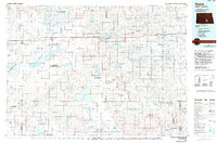
1979 Map of Kintyre NE
USGS Topo · Published 1980About this map
Manning and Bunker townships define this central North Dakota landscape, where the survey captures a late-century agricultural and wildlife management pattern. The northern portion of the quadrangle is dominated by the Dawson State Game Management Area, highlighting the region's commitment to prairie conservation and habitat. The section lines are clearly marked with rural infrastructure, including a Townhall and Radio Tower in the southeastern quadrant, alongside numerous wells that speak to the area's water-dependent farming operations.
Find a feature on this map
12 named features on this map. Tap any name to fly to it.
Don’t see what you’re looking for? This feature index may not catch every label — zoom into the map to look around manually.
Map Details
Editions of this 1979 Kintyre NE Map
This is the sole edition of this map. No revisions or reprints were ever made.
Other maps of this area

1952 · Tappen South
USGS Topo · 1:24,000

1952 · Dawson
USGS Topo · 1:24,000

1952 · Steele
USGS Topo · 1:24,000

1953 · Jamestown
USGS Topo · 1:250,000

1956 · Jamestown
USGS Topo · 1:250,000

1975 · Kintyre
USGS Topo · 1:24,000

1980 · McKenna Lake North
USGS Topo · 1:24,000

1983 · Alkaline Lake SW
USGS Topo · 1:24,000

1983 · Alkaline Lake NW
USGS Topo · 1:24,000
1985 · Steele
USGS Topo · 1:100,000