
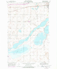
1952 Map of Dawson
USGS Topo · Published 1954About this map
The settlement of Dawson sits at a critical junction of commerce and terrain in central North Dakota, anchored by the Northern Pacific railroad corridor. The landscape is defined by its substantial water bodies, particularly the sprawling Alkaline Lake, Lake Isabel, and Manning Lake, which dominate the southern half of the quadrangle. These lakes are separated by subtle topographic rises like Sibley and Woodlawn, indicating a post-glacial pothole region where drainage and water levels were primary factors in land use. Local education and community life are represented by the rural Liberty Sch, situated south of the main township. This survey, compiled from 1951 aerial photography, provides a precise record of the prairie section lines and early transport routes before modern infrastructure changes modified the shoreline environments.
Find a feature on this map
8 named features on this map. Tap any name to fly to it.
Don’t see what you’re looking for? This feature index may not catch every label — zoom into the map to look around manually.
Map Details
Editions of this 1952 Dawson Map
2 editions found
Other maps of this area

1952 · Tappen South
USGS Topo · 1:24,000

1952 · Tappen North
USGS Topo · 1:24,000

1952 · Steele NE
USGS Topo · 1:24,000

1952 · Steele
USGS Topo · 1:24,000

1952 · Steele NW
USGS Topo · 1:24,000

1953 · Jamestown
USGS Topo · 1:250,000

1956 · Jamestown
USGS Topo · 1:250,000
1975 · Tappen North
USGS Topo · 1:24,000

1979 · Kintyre NE
USGS Topo · 1:24,000

1983 · Alkaline Lake NW
USGS Topo · 1:24,000