
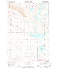
1952 Map of Steele NE
USGS Topo · Published 1954About this map
The town of Dawson anchors the southern edge of this mid-century survey, a region defined by its complex network of prairie potholes and wetlands. This 1952 topographic study reveals a landscape dominated by shifting water bodies, including the expansive Buffalo Lake and the nearby Dead Buffalo Lake, alongside Sibley Lake and Big Muddy Lake. These features reflect the post-glacial geography of Kidder County, where small depressions create a dense pattern of seasonal and permanent lakes across townships like Allen and Vernon.
Find a feature on this map
17 named features on this map. Tap any name to fly to it.
Don’t see what you’re looking for? This feature index may not catch every label — zoom into the map to look around manually.
Map Details
Editions of this 1952 Steele NE Map
2 editions found
Other maps of this area

1952 · Tappen South
USGS Topo · 1:24,000

1952 · Dawson
USGS Topo · 1:24,000

1952 · Tappen North
USGS Topo · 1:24,000

1952 · Steele
USGS Topo · 1:24,000

1952 · Steele NW
USGS Topo · 1:24,000

1952 · New Rockford
USGS Topo · 1:250,000

1953 · Jamestown
USGS Topo · 1:250,000

1956 · New Rockford
USGS Topo · 1:250,000

1956 · Jamestown
USGS Topo · 1:250,000

1971 · New Rockford
USGS Topo · 1:250,000