
1975 Map of Kintyre
USGS Topo · Published 1978About this map
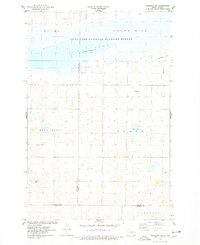
Kintyre serves as the central hub of this prairie landscape, situated where the Soo Line railroad crosses the plains of Emmons and Logan Counties. The topography is defined by the natural depressions and basins of the glaciated Missouri Plateau, including water bodies like Stink Lake, Goose Lake, and Sealy. Large portions of the northern terrain are dedicated to conservation through the National Waterfowl Production Area, reflecting the region's importance to the Central Flyway. This mid-1970s survey captures the rural character of the area, showing a network of section roads and scattered township names like Campbell, Kroeber, and Tell. Local industry is represented by numerous small Gravel Pits located near the townsite and rail line, providing material for the essential road networks connecting these prairie townships.
Find a feature on this map
11 named features on this map. Tap any name to fly to it.
Don’t see what you’re looking for? This feature index may not catch every label — zoom into the map to look around manually.
Map Details
Editions of this 1975 Kintyre Map
This is the sole edition of this map. No revisions or reprints were ever made.
Other maps of this area

1953 · Jamestown
USGS Topo · 1:250,000

1954 · Bismarck
USGS Topo · 1:250,000

1956 · Jamestown
USGS Topo · 1:250,000

1958 · Bismarck
USGS Topo · 1:250,000

1975 · Linton NE
USGS Topo · 1:24,000

1975 · Braddock
USGS Topo · 1:24,000
1975 · Braddock NE
USGS Topo · 1:24,000

1979 · Bismarck
USGS Topo · 1:100,000

1979 · Kintyre NE
USGS Topo · 1:24,000

1979 · Schell Buttes NW
USGS Topo · 1:24,000