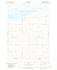
1975 Map of Braddock NE
USGS Topo · Published 1978About this map
Long Lake National Wildlife Refuge dominates the northern landscape of this 1970s survey, illustrating the critical importance of wetlands in the Dakota prairie. The map details the expansive waters of Long Lake, where an official water measurement from October 1974 is preserved. Moving south from the water's edge, the terrain shifts into the township divisions of Wild Rose, Baker, and Campbell, revealing a land defined by section lines and agricultural persistence. The topography is marked by distinct rises like Thelma and Crown Hill, while small features such as Mud Lake and scattered Gravel Pits indicate the local resources and natural depressions common to Kidder and Burleigh counties. This document provides an exacting look at the field lines and property boundaries that structured this rural landscape during the mid-1970s.
Find a feature on this map
14 named features on this map. Tap any name to fly to it.
Don’t see what you’re looking for? This feature index may not catch every label — zoom into the map to look around manually.
Map Details
Editions of this 1975 Braddock NE Map
This is the sole edition of this map. No revisions or reprints were ever made.
Other maps of this area

1951 · Driscoll
USGS Topo · 1:62,500

1952 · Steele
USGS Topo · 1:24,000

1953 · Jamestown
USGS Topo · 1:250,000

1954 · Bismarck
USGS Topo · 1:250,000

1956 · Jamestown
USGS Topo · 1:250,000

1958 · Bismarck
USGS Topo · 1:250,000

1975 · Lake Geneva
USGS Topo · 1:24,000
1975 · Driscoll
USGS Topo · 1:24,000

1975 · Dana
USGS Topo · 1:24,000
1975 · Braddock NW
USGS Topo · 1:24,000