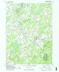
1957 Map of Maybrook
USGS Topo · Published 1981About this map
Maybrook and the surrounding Orange County townships are defined by the convergence of industrial rail infrastructure and traditional rural hamlets. The Conrail network creates a central spine through the landscape, connecting settlements like Burnside, Washingtonville, and Craigville. Local family history is preserved in numerous burial grounds across the quadrangle, including the Bull Cem and Woodhull Cem, while religious life centers on landmarks like St Marys Ch.
Find a feature on this map
70 named features on this map. Tap any name to fly to it.
Don’t see what you’re looking for? This feature index may not catch every label — zoom into the map to look around manually.
Map Details
Editions of this 1957 Maybrook Map
4 editions found
Other maps of this area

1902 · Schunemunk
USGS Topo · 1:62,500

1903 · Newburg
USGS Topo · 1:62,500

1904 · Ellenville
USGS Topo · 1:62,500

1906 · Ellenville
USGS Topo · 1:62,500

1906 · Goshen
USGS Topo · 1:62,500

1908 · Goshen
USGS Topo · 1:62,500

1930 · Schunemunk
USGS Topo · 1:48,000

1935 · Schunemunk
USGS Topo · 1:62,500

1938 · Goshen
USGS Topo · 1:62,500

1942 · Goshen
USGS Topo · 1:24,000