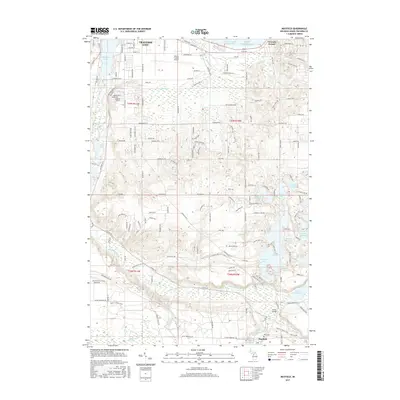
2017 Map of Mayfield
USGS Topo · Published 2017About this map
Traverse City anchors the northern reaches of this landscape, where the East Arm Grand Traverse Bay of Lake Michigan meets the urban fringe. The terrain transitions from the developed grids of the city and the Cherry Capital Airport into a dense network of glacial kettle lakes and wetlands to the southeast. The Boardman River is a central corridor here, winding through a series of impoundments including Sabin Pond, Keystone Pond, and the expansive Brown Bridge Pond.
Find a feature on this map
170 named features on this map. Tap any name to fly to it.
Don’t see what you’re looking for? This feature index may not catch every label — zoom into the map to look around manually.
Map Details
Editions of this 2017 Mayfield Map
This is the sole edition of this map. No revisions or reprints were ever made.
Other maps of this area

1954 · Traverse City
USGS Topo · 1:250,000

1956 · Fife Lake
USGS Topo · 1:62,500

1956 · Kingsley
USGS Topo · 1:62,500

1957 · Traverse City
USGS Topo · 1:62,500

1957 · Elk Rapids
USGS Topo · 1:62,500

1958 · Traverse City
USGS Topo · 1:250,000

1983 · Buckley
USGS Topo · 1:25,000

1983 · Traverse City SE
USGS Topo · 1:25,000

1983 · Traverse City
USGS Topo · 1:100,000
1983 · Grawn
USGS Topo · 1:25,000
Featured Places
- Garfield Township, MI
- Traverse City, MI
- East Bay Charter Township, East Bay Township
- East Bay Township, MI
- Blair Township, MI