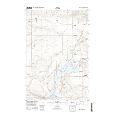
2013 Map of Mayfield Lake
USGS Topo · Published 2013About this map
Mayfield Lake dominates this Lewis County landscape, its winding shoreline and recreation areas like the Ike Kinswa Campground defining the modern character of the region. The valley floor is a mix of agricultural and industrial utility, evidenced by the Mossyrock Trout Hatchery and the broad Klickitat Prairie near the settlement of Mossyrock. To the north, the terrain transitions into the more secluded Shoestring Valley, where the smaller communities of Alpha and Cinebar are connected by a network of rural routes including Wa-508. The map documents a complex drainage system where Mill Cr and the Tilton River converge toward the reservoir, while the Klickitat Cem stands as a grounded landmark for those researching family history in the settlements of Mayfield and Silver Creek.
Find a feature on this map
120 named features on this map. Tap any name to fly to it.
Don’t see what you’re looking for? This feature index may not catch every label — zoom into the map to look around manually.
Map Details
Editions of this 2013 Mayfield Lake Map
This is the sole edition of this map. No revisions or reprints were ever made.
Other maps of this area

1916 · Chehalis
USGS Topo · 1:125,000

1919 · Mount St Helens
USGS Topo · 1:125,000

1937 · Eatonville
USGS Topo · 1:125,000

1942 · Toutle
USGS Topo · 1:62,500

1943 · Willapa
USGS Topo · 1:62,500

1953 · Hoquiam
USGS Topo · 1:250,000

1953 · Toutle
USGS Topo · 1:62,500

1953 · Elk Rock
USGS Topo · 1:62,500

1954 · Onalaska
USGS Topo · 1:62,500

1957 · Hoquiam
USGS Topo · 1:250,000