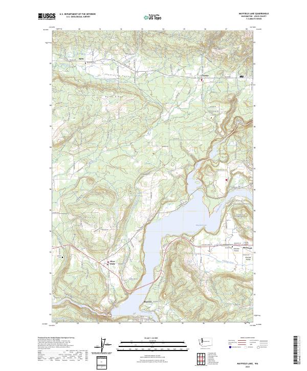
2023 Map of Mayfield Lake
USGS Topo · Published 2023About this map
Shoestring Valley and the Klickitat Prairie anchor this section of Lewis County, where the Tilton River flows into the expansive Mayfield Lake. This landscape is defined by the convergence of several major water systems, including the Cowlitz River, Winston Creek, and Klickitat Creek. The settlement pattern follows these waterways and natural valleys, with small communities like Alpha, Cinebar, and Silver Creek positioned along historical transit corridors. Local history is preserved at the Shoestring Cem and Salkum Cem, reflecting the early pioneer roots of the region. The topography transitions from the low-lying lake margins to the elevated terrain of Burnt Ridge, demonstrating the complex drainage of the Cowlitz River basin before it reaches the dammed reservoir at Mayfield.
Find a feature on this map
94 named features on this map. Tap any name to fly to it.
Don’t see what you’re looking for? This feature index may not catch every label — zoom into the map to look around manually.
Map Details
Editions of this 2023 Mayfield Lake Map
This is the sole edition of this map. No revisions or reprints were ever made.
Other maps of this area

1916 · Chehalis
USGS Topo · 1:125,000

1919 · Mount St Helens
USGS Topo · 1:125,000

1937 · Eatonville
USGS Topo · 1:125,000

1942 · Toutle
USGS Topo · 1:62,500

1943 · Willapa
USGS Topo · 1:62,500

1953 · Hoquiam
USGS Topo · 1:250,000

1953 · Toutle
USGS Topo · 1:62,500

1953 · Elk Rock
USGS Topo · 1:62,500

1954 · Onalaska
USGS Topo · 1:62,500

1957 · Hoquiam
USGS Topo · 1:250,000