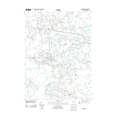
2012 Map of Maynard
USGS Topo · Published 2012About this map
Maynard and its industrial heritage along the Assabet River define this portion of Middlesex County during the early 21st century. The landscape reveals a complex network of established settlements, including Acton, Sudbury, and the distinct hamlets of West Acton, South Acton, and East Acton. The importance of water power to the region's development is evident in the presence of Damons Mills and Westvale, as well as numerous impoundments like the Fort Pond Brook Reservoir, Millpond, and Stearns Millpond. Local history and genealogy researchers will find significant value in the distribution of burial sites across the townships, such as Mount Hope Cem, Woodlawn Cem, and Saint Bridgets Cem. The terrain is marked by numerous named elevations, from Tuttle Hill near the river to Annursnac Hill and Strawberry Hill in the north, showing how the suburban expansion of the Boston area has integrated with the area's natural drumlins and wetlands.
Find a feature on this map
291 named features on this map. Tap any name to fly to it.
Don’t see what you’re looking for? This feature index may not catch every label — zoom into the map to look around manually.
Map Details
Editions of this 2012 Maynard Map
This is the sole edition of this map. No revisions or reprints were ever made.
Other maps of this area

1886 · Lowell
USGS Topo · 1:62,500

1886 · Framingham
USGS Topo · 1:62,500

1887 · Marlboro
USGS Topo · 1:62,500

1889 · Marlboro
USGS Topo · 1:62,500

1889 · Framingham
USGS Topo · 1:62,500

1893 · Lowell
USGS Topo · 1:62,500

1893 · Groton
USGS Topo · 1:62,500

1894 · Framingham
USGS Topo · 1:62,500

1896 · Marlboro
USGS Topo · 1:62,500

1898 · Marlboro
USGS Topo · 1:62,500