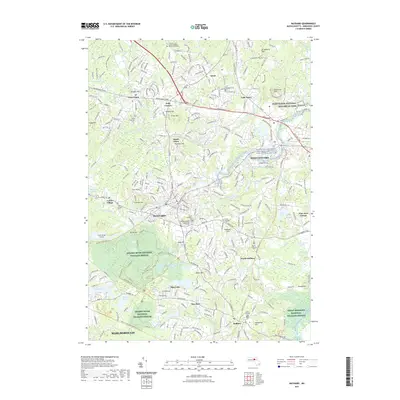
2021 Map of Maynard
USGS Topo · Published 2021About this map
The Assabet River flows through the heart of Maynard, a landscape defined by its conversion of former industrial and rail corridors into conservation land. To the south and west, the Assabet River National Wildlife Refuge preserves extensive wetlands and wooded terrain, while the Assabet River Rail Trl follows the path of former rail transit. Small settlements like Kelly Corner, South Acton, and West Acton are connected by historically significant routes such as Massachusetts Ave and the Union Tpke. This modern survey details several local burial grounds, including Mount Hope Cem and Saint Bridget's Cem, which serve as vital points of interest for genealogists tracing family histories in Middlesex County. The eastern edge captures a portion of the Minute Man National Historical Park, where the suburban landscape meets protected national history.
Find a feature on this map
79 named features on this map. Tap any name to fly to it.
Don’t see what you’re looking for? This feature index may not catch every label — zoom into the map to look around manually.
Map Details
Editions of this 2021 Maynard Map
This is the sole edition of this map. No revisions or reprints were ever made.
Other maps of this area

1886 · Lowell
USGS Topo · 1:62,500

1886 · Framingham
USGS Topo · 1:62,500

1887 · Marlboro
USGS Topo · 1:62,500

1889 · Marlboro
USGS Topo · 1:62,500

1889 · Framingham
USGS Topo · 1:62,500

1893 · Lowell
USGS Topo · 1:62,500

1893 · Groton
USGS Topo · 1:62,500

1894 · Framingham
USGS Topo · 1:62,500

1896 · Marlboro
USGS Topo · 1:62,500

1898 · Marlboro
USGS Topo · 1:62,500