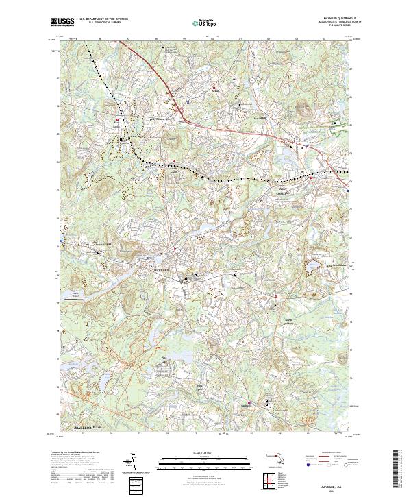
2024 Map of Maynard
USGS Topo · Published 2024About this map
The Assabet River winds through this Middlesex County landscape, connecting a series of historic mill towns and villages including Maynard, Acton, and Sudbury. In the northeast corner, a portion of the Minute Man National Historical Park preserves the area’s colonial heritage, including the James Chandler Gravesite. The map reveals a dense network of local-history landmarks, from the Revolutionary War Cem in Sudbury to the Concord Reformatory Cem near West Concord. Transportation history is evident in the conversion of old rail corridors to modern paths like the Assabet River Rail-Trl and the Mass Central Wayside Rail Trl, which follow the routes that once fueled the regional industrial economy. Water features like Lake Boon and White Pond contrast with preserved marshes such as Cold Brook Meadow and the Sedge Meadows.
Find a feature on this map
106 named features on this map. Tap any name to fly to it.
Don’t see what you’re looking for? This feature index may not catch every label — zoom into the map to look around manually.
Map Details
Editions of this 2024 Maynard Map
This is the sole edition of this map. No revisions or reprints were ever made.
Other maps of this area

1886 · Lowell
USGS Topo · 1:62,500

1886 · Framingham
USGS Topo · 1:62,500

1887 · Marlboro
USGS Topo · 1:62,500

1889 · Marlboro
USGS Topo · 1:62,500

1889 · Framingham
USGS Topo · 1:62,500

1893 · Lowell
USGS Topo · 1:62,500

1893 · Groton
USGS Topo · 1:62,500

1894 · Framingham
USGS Topo · 1:62,500

1896 · Marlboro
USGS Topo · 1:62,500

1898 · Marlboro
USGS Topo · 1:62,500