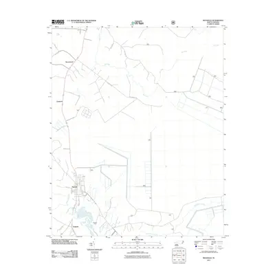
2011 Map of Maysville
USGS Topo · Published 2011About this map
Maysville and Belgrade anchor the southern reaches of this landscape, where the White Oak River and Black Swamp Creek converge. The area is defined by a transition from organized street grids in the town centers to rural residential tracts and industrial sites like the Belgrade Quarry. Smaller settlements including Ravenswood and Chadwick appear to the north, connected by a network of local routes such as Ravenwood Rd and Riggstown Rd. The eastern portion of the quadrangle is largely dominated by the drainage of Mill Creek, showing the low-lying coastal plain characteristic of Jones County. Notable local identifiers, including Donnie S Sawmill and Catfish Lake Rd, provide specific points of interest for those researching the modern development and timber-related geography of this North Carolina region.
Find a feature on this map
37 named features on this map. Tap any name to fly to it.
Don’t see what you’re looking for? This feature index may not catch every label — zoom into the map to look around manually.
Map Details
Editions of this 2011 Maysville Map
This is the sole edition of this map. No revisions or reprints were ever made.
Other maps of this area

1901 · New Bern
USGS Topo · 1:62,500

1903 · New Bern
USGS Topo · 1:62,500

1903 · Trent River
USGS Topo · 1:62,500

1904 · Trent River
USGS Topo · 1:62,500

1942 · Maysville
USGS Topo · 1:62,500

1943 · Jacksonville
USGS Topo · 1:62,500

1948 · Maysville
USGS Topo · 1:62,500

1950 · Pollocksville
USGS Topo · 1:24,000

1950 · New Bern
USGS Topo · 1:24,000

1953 · Rocky Mount
USGS Topo · 1:250,000