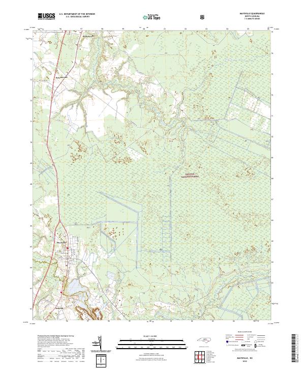
2022 Map of Maysville
USGS Topo · Published 2022About this map
The White Oak River serves as the central artery for this region of Jones County, delineating the natural boundary between Maysville and Belgrade near the Onslow County line. To the east, the landscape is dominated by the dense wetlands of the Croatan National Forest, where a network of drainage features like Black Swamp Cr and Mill Creek define the low-lying terrain. These waterways were essential to the early development of local industry, as evidenced by Donnie's Sawmill situated near the riverbanks.
Find a feature on this map
39 named features on this map. Tap any name to fly to it.
Don’t see what you’re looking for? This feature index may not catch every label — zoom into the map to look around manually.
Map Details
Editions of this 2022 Maysville Map
This is the sole edition of this map. No revisions or reprints were ever made.
Other maps of this area

1901 · New Bern
USGS Topo · 1:62,500

1903 · New Bern
USGS Topo · 1:62,500

1903 · Trent River
USGS Topo · 1:62,500

1904 · Trent River
USGS Topo · 1:62,500

1942 · Maysville
USGS Topo · 1:62,500

1943 · Jacksonville
USGS Topo · 1:62,500

1948 · Maysville
USGS Topo · 1:62,500

1950 · Pollocksville
USGS Topo · 1:24,000

1950 · New Bern
USGS Topo · 1:24,000

1953 · Rocky Mount
USGS Topo · 1:250,000