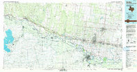
1992 Map of Mc Allen
USGS Topo · Published 1993About this map
The Rio Grande defines the character of this border region, winding through a complex system of agricultural lands and wildlife sanctuaries. In the early 1990s, the landscape between Rio Grande City and Weslaco shows a distinct pattern of long, narrow tracts extending from the river, intersected by the Main Road and several irrigation channels. This era marks a significant concentration of conservation areas, including the Bentsen-Rio Grande Valley State Park and the Santa Ana National Wildlife Refuge, which preserve the native riparian brushland amidst the expanding urban footprints of Mc Allen and Pharr. To the north, the Yturria Oil Field and La Union Oil Field indicate the industrial weight of the region's petroleum sector, while the presence of the Main Floodway highlights the sophisticated water management required in this flood-prone delta.
Find a feature on this map
81 named features on this map. Tap any name to fly to it.
Don’t see what you’re looking for? This feature index may not catch every label — zoom into the map to look around manually.
Map Details
Editions of this 1992 Mc Allen Map
This is the sole edition of this map. No revisions or reprints were ever made.
Other maps of this area

1914 · San Juan
USGS Topo · 1:48,000

1916 · San Juan
USGS Topo · 1:62,500

1922 · La Sal Vieja
USGS Topo · 1:62,500

1938 · Falcon
USGS Topo · 1:62,500

1938 · El Sauz
USGS Topo · 1:62,500

1938 · Sal Colorada
USGS Topo · 1:62,500

1939 · Linn
USGS Topo · 1:62,500

1939 · La Reforma
USGS Topo · 1:62,500

1940 · Monte Christo
USGS Topo · 1:62,500

1949 · Mc Allen
USGS Topo · 1:250,000