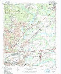
1986 Map of Mc Almont
USGS Topo · Published 1988About this map
North Little Rock and its expanding northern suburbs of Sherwood and Sylvan Hills are defined by a complex network of bayous, small lakes, and infrastructure in this mid-1980s landscape. The northeast corner of Camp Joseph T Robinson anchors the northwestern quadrant, while the Missouri Pacific railroad cuts a diagonal path toward Jacksonville. The map captures the suburban growth of the era, visible in the densely packed residential streets of Lakewood and the numerous educational facilities like Northeast High School and Lakewood Junior High.
Find a feature on this map
84 named features on this map. Tap any name to fly to it.
Don’t see what you’re looking for? This feature index may not catch every label — zoom into the map to look around manually.
Map Details
Editions of this 1986 Mc Almont Map
3 editions found
Other maps of this area

1891 · Little Rock
USGS Topo · 1:125,000

1893 · Little Rock
USGS Topo · 1:125,000

1935 · Mc Almont
USGS Topo · 1:24,000

1935 · Little Rock
USGS Topo · 1:24,000

1935 · Sweet Home
USGS Topo · 1:24,000

1935 · North Little Rock
USGS Topo · 1:24,000

1935 · Alexander
USGS Topo · 1:48,000

1941 · Alexander
USGS Topo · 1:62,500

1941 · Olmstead
USGS Topo · 1:31,680

1941 · Cabot
USGS Topo · 1:31,680
Featured Places
- North Little Rock, AR
- Jacksonville, AR
- Sherwood, AR
- Lakewood, North Little Rock
- Millers Crossing, Sherwood