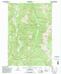
1994 Map of Mc Coy Peak
USGS Topo · Published 1996About this map
Gifford Pinchot National Forest dominates this mid-1990s revision of the Cascades high country, a landscape defined by prominent volcanic peaks and ridgelines. Central to the sheet is the eponymous McCoy Peak, flanked by other notable summits including Langille Peak, Sunrise Peak, and Jumbo Peak. The map reveals a complex drainage network where McCoy Creek and its many tributaries, such as Sunrise Creek and Badger Creek, carve through the steep terrain. This area, updated with Forest Service data from a 1994 field check, highlights the importance of recreation and backcountry access via routes like the French Creek Trail. The map documents a rugged wilderness largely devoid of permanent settlements, focused instead on landmarks such as Yellow Jacket Pass and Dark Meadow, which serve as critical navigational points for explorers and forest managers alike.
Find a feature on this map
33 named features on this map. Tap any name to fly to it.
Don’t see what you’re looking for? This feature index may not catch every label — zoom into the map to look around manually.
Map Details
Editions of this 1994 Mc Coy Peak Map
This is the sole edition of this map. No revisions or reprints were ever made.
Other maps of this area

1926 · Steamboat Mtn
USGS Topo · 1:125,000

1931 · Steamboat Mtn
USGS Topo · 1:125,000

1950 · Yakima
USGS Topo · 1:250,000

1958 · Yakima
USGS Topo · 1:250,000

1961 · Yakima
USGS Topo · 1:250,000
1965 · Greenhorn Buttes
USGS Topo · 1:24,000
1965 · Spencer Butte
USGS Topo · 1:24,000
1965 · Tower Rock
USGS Topo · 1:24,000
1965 · Quartz Creek Butte
USGS Topo · 1:24,000
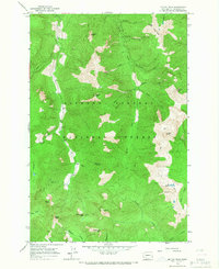
1965 · Mc Coy Peak
USGS Topo · 1:24,000