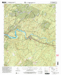
2003 Map of Mc Farland
USGS Topo · Published 2004About this map
Reliance and the surrounding mountain ridges of the Cherokee National Forest anchor this study of Polk and Monroe Counties. The Hiwassee River is the central artery of the landscape, carving through steep terrain at The Narrows and surrounding numerous landforms such as Big Rock Island and Cane Island. Along its banks, the Apalachia Reservation and the Appalachia Powerhouse indicate the river's industrial importance, supported by the route of the L & N RR.
Find a feature on this map
80 named features on this map. Tap any name to fly to it.
Don’t see what you’re looking for? This feature index may not catch every label — zoom into the map to look around manually.
Map Details
Editions of this 2003 Mc Farland Map
This is the sole edition of this map. No revisions or reprints were ever made.
Other maps of this area

1886 · Cleveland
USGS Topo · 1:125,000

1892 · Cleveland
USGS Topo · 1:125,000

1893 · Murphy
USGS Topo · 1:125,000

1895 · Cleveland
USGS Topo · 1:125,000

1901 · Cleveland
USGS Topo · 1:125,000

1914 · Murphy
USGS Topo · 1:125,000

1934 · Mecca
USGS Topo · 1:24,000

1934 · Tellico Plains
USGS Topo · 1:24,000

1935 · Tellico
USGS Topo · 1:48,000
1935 · Oswald Bald
USGS Topo · 1:24,000