
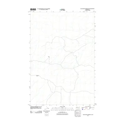
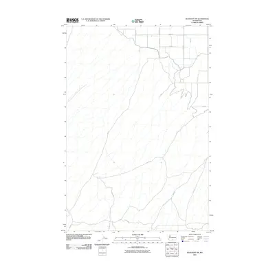
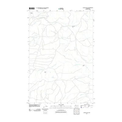
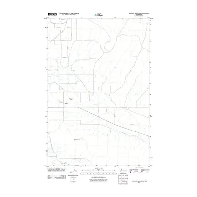
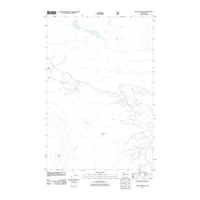
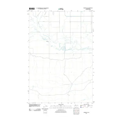
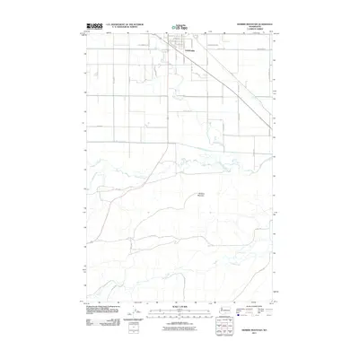
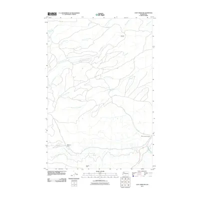
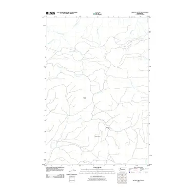
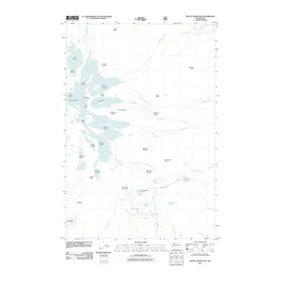
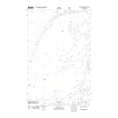
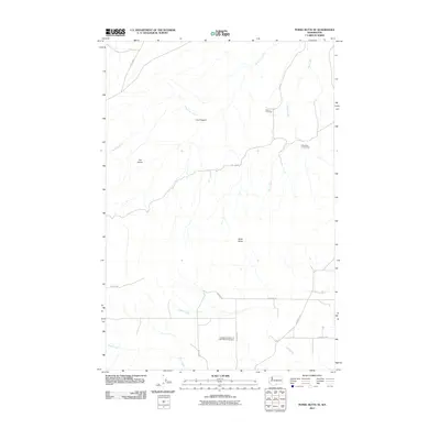
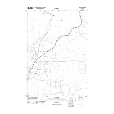
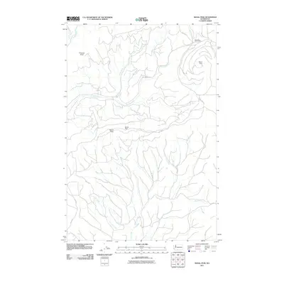
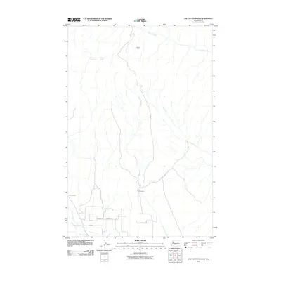
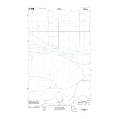
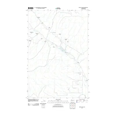
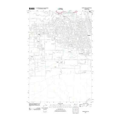
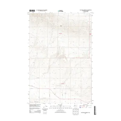
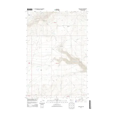
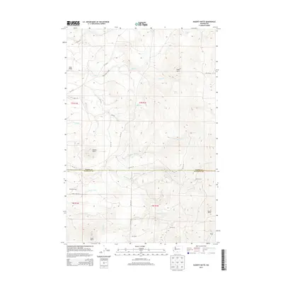
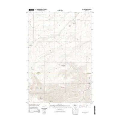
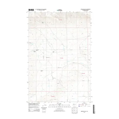
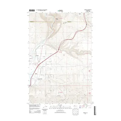
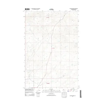
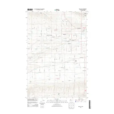
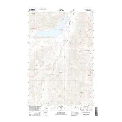
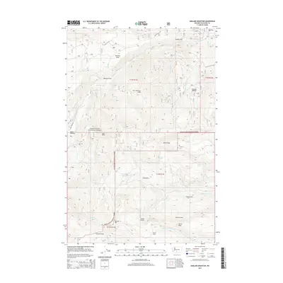
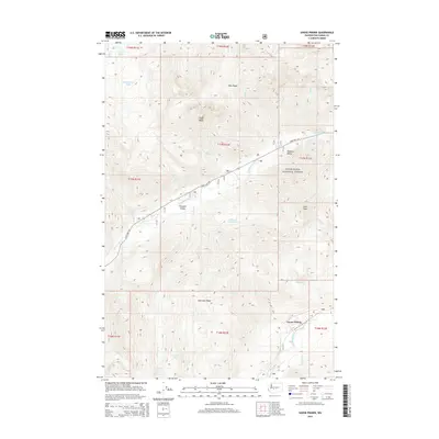
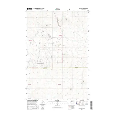
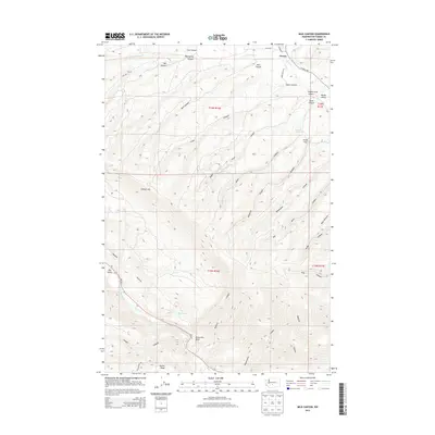
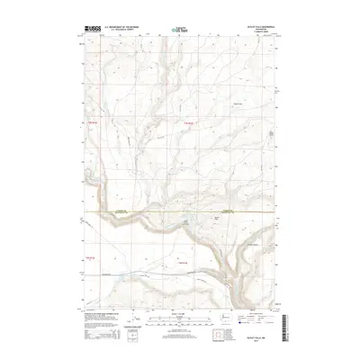
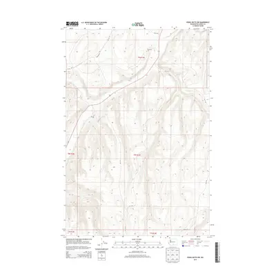
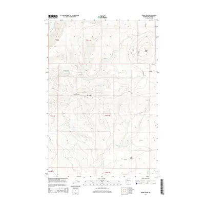
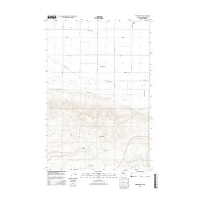
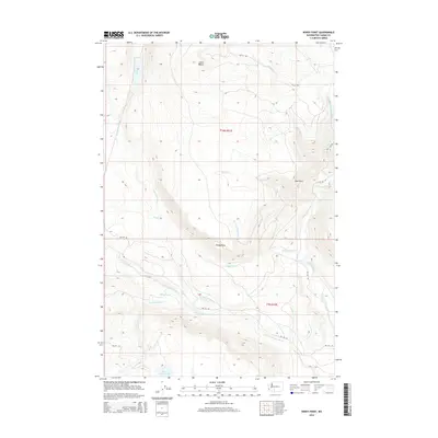
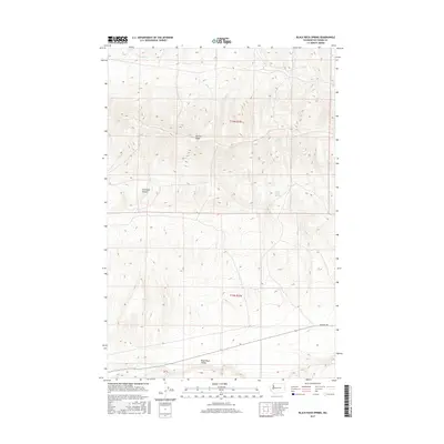
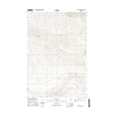
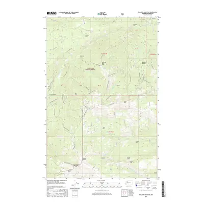
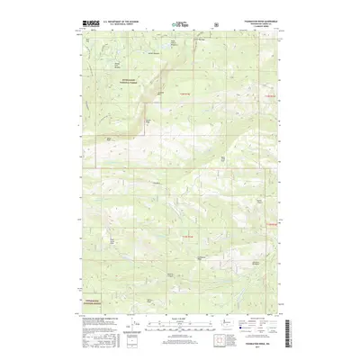
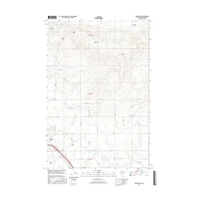
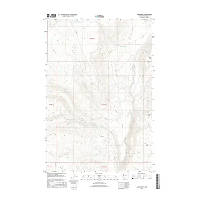
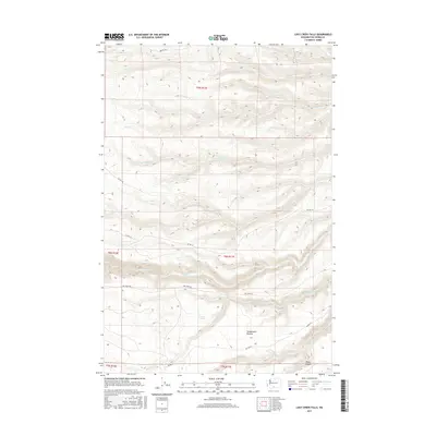
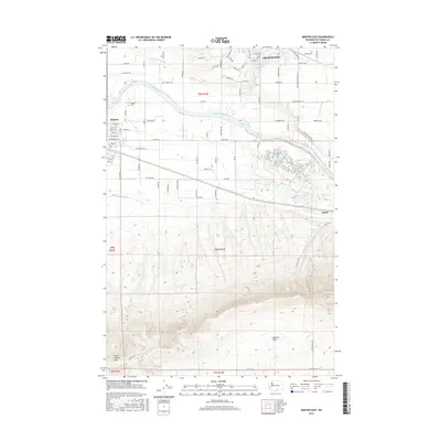
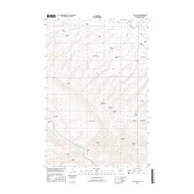
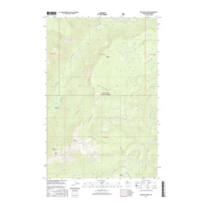
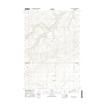
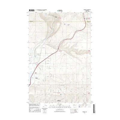
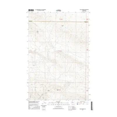
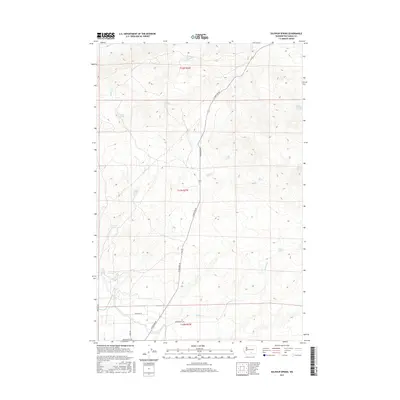
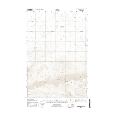
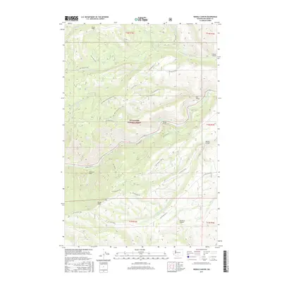
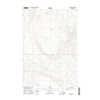
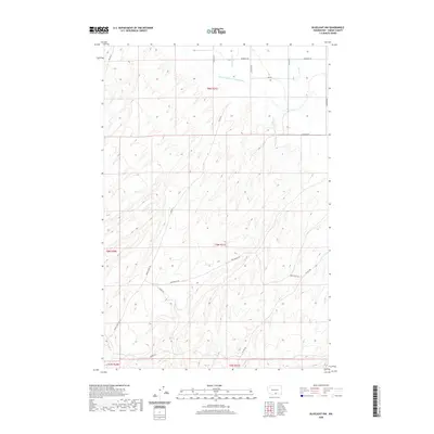
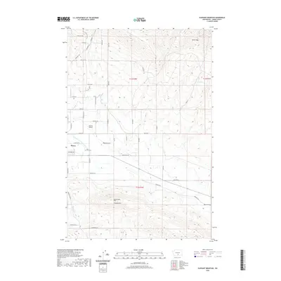
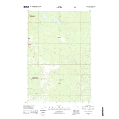
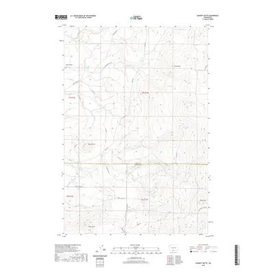
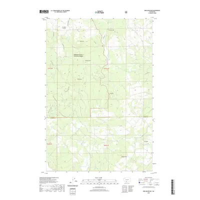
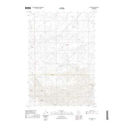
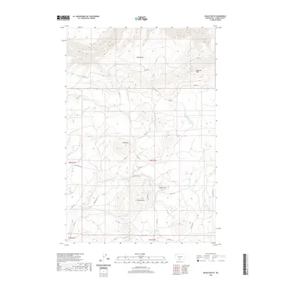
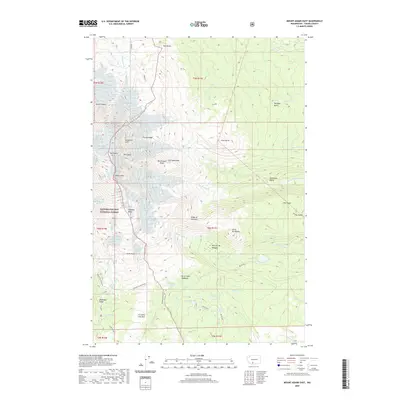
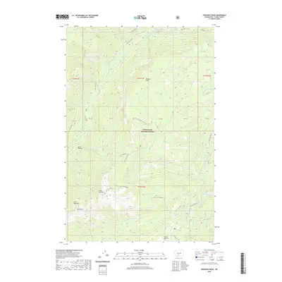
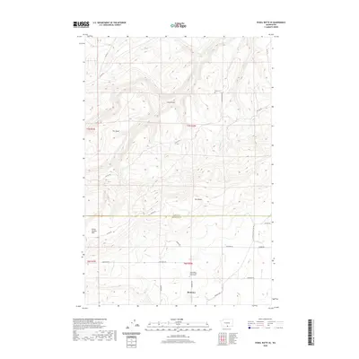
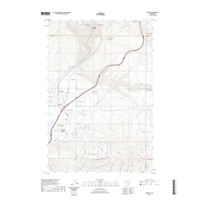
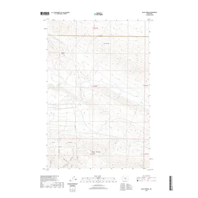
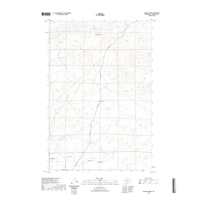
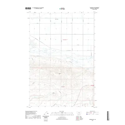
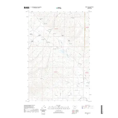
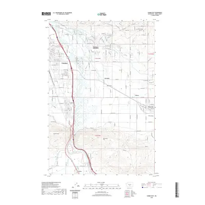
1965 Map of Mc Kays Butte
USGS Topo · Published 1967About this map
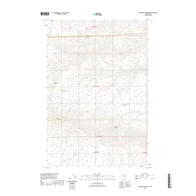
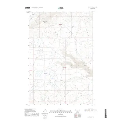
Toppenish Ridge and the heights of Signal Peak dominate this mid-1960s survey of Yakima County, Washington. The landscape is defined by its water sources and high-elevation landmarks, including volcanic features like Simon Butte and Mc Kays Butte, which are surrounded by numerous isolated springs such as Delaney Spring and Vessey Springs. A critical historical marker, the Old Indian Treaty Boundary, cuts across the terrain, indicating the legal and cultural divisions of the era. Evidence of land use is visible in the network of light-duty and unimproved routes like Tepee Creek Rd and Satus Ranger Station Road, which provide access to localized resource extraction at Cinder Pit. This map preserves the mid-century spatial arrangement of these remote forest and ridge lands before modern development patterns emerged.
Find a feature on this map
34 named features on this map. Tap any name to fly to it.
Don’t see what you’re looking for? This feature index may not catch every label — zoom into the map to look around manually.
Map Details
Editions of this 1965 Mc Kays Butte Map
This is the sole edition of this map. No revisions or reprints were ever made.
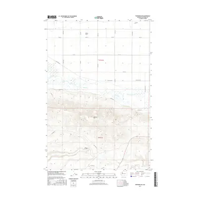
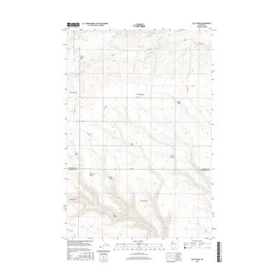
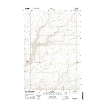
Historical Maps of Yakima County Through Time
480 maps found

1902 Mount Aix
Yakima County, WA

1904 Mount Adams
Yakima County, WA

1904 Mount Aix
Yakima County, WA

1907 Mount Adams
Yakima County, WA

1936 Hog Ranch Buttes
Yakima County, WA

1936 Yakima East
Yakima County, WA

1941 Black Rock Spring
Yakima County, WA

1941 Yakima East
Yakima County, WA

1948 Cairn Hope Peak
Yakima County, WA

1953 Black Rock Spring NE
Yakima County, WA

1953 Black Rock Spring NW
Yakima County, WA

1953 Black Rock Spring SW
Yakima County, WA

1953 Black Rock Spring
Yakima County, WA

1953 Black Rock Spring
Yakima County, WA

1953 Elephant Mountain
Yakima County, WA

1953 Pomona
Yakima County, WA

1953 Selah Springs
Yakima County, WA

1953 Yakima East
Yakima County, WA

1953 Yakima East
Yakima County, WA

1955 Prosser SW
Yakima County, WA

1957 Willy Dick Canyon
Yakima County, WA

1957 Yesmowit Canyon
Yakima County, WA

1958 Fort Simcoe
Yakima County, WA

1958 Fort Simcoe
Yakima County, WA

1958 Harrah SE
Yakima County, WA

1958 Hembre Mtn
Yakima County, WA

1958 Medicine Valley
Yakima County, WA

1958 Toppenish Mtn.
Yakima County, WA

1958 Toppenish SW
Yakima County, WA

1958 Wiley City
Yakima County, WA

1958 Yakima West
Yakima County, WA

1962 Bumping Lake
Yakima County, WA

1962 White Pass
Yakima County, WA

1964 Granger NE
Yakima County, WA

1965 Bluelight NW
Yakima County, WA

1965 Bluelight
Yakima County, WA

1965 Bluelight
Yakima County, WA

1965 Camas Patch
Yakima County, WA

1965 Granger NW
Yakima County, WA

1965 Hagerty Butte
Yakima County, WA

1965 Kusshi Creek
Yakima County, WA

1965 Logy Creek Falls
Yakima County, WA

1965 Logy Creek NE
Yakima County, WA

1965 Logy Creek SW
Yakima County, WA

1965 Logy Creek
Yakima County, WA

1965 Mabton East
Yakima County, WA

1965 Mabton West
Yakima County, WA
1965 Mc Kays Butte
Yakima County, WA

1965 Poisel Butte NW
Yakima County, WA

1965 Poisel Butte SE
Yakima County, WA

1965 Poisel Butte SW
Yakima County, WA

1965 Poisel Butte
Yakima County, WA

1965 Poisel Butte
Yakima County, WA

1965 Prosser SW
Yakima County, WA

1965 Stagman Butte
Yakima County, WA

1965 Tule Prong
Yakima County, WA

1967 Darland Mtn
Yakima County, WA

1967 Foundation Ridge
Yakima County, WA

1967 Rimrock Lake
Yakima County, WA

1967 Tieton Basin
Yakima County, WA

1968 Twin Buttes
Yakima County, WA

1969 Castile Falls
Yakima County, WA

1970 Castile Falls
Yakima County, WA

1970 Fairview Ridge
Yakima County, WA

1970 Glaciate Butte
Yakima County, WA

1970 Jennies Butte
Yakima County, WA

1970 Jungle Butte
Yakima County, WA

1970 Lost Horse Plateau
Yakima County, WA

1970 Mount Adams East
Yakima County, WA

1970 Outlet Falls
Yakima County, WA

1970 Piscoe Meadow
Yakima County, WA

1970 Poland Butte
Yakima County, WA

1970 Signal Peak
Yakima County, WA

1970 Windy Point
Yakima County, WA

1971 King Mountain
Yakima County, WA

1971 Meeks Table
Yakima County, WA

1971 Milk Canyon
Yakima County, WA

1971 Old Scab Mtn.
Yakima County, WA

1971 Pine Mtn.
Yakima County, WA

1971 Timberwolf Mtn.
Yakima County, WA

1971 Weddle Canyon
Yakima County, WA

1978 Mount Rainier
Yakima County, WA

1978 Sulphur Spring
Yakima County, WA

1984 The Cottonwoods
Yakima County, WA

1985 Wenas Lake
Yakima County, WA

1988 Bumping Lake
Yakima County, WA

1988 Cougar Lake
Yakima County, WA

1988 Goose Prairie
Yakima County, WA

1988 Norse Peak
Yakima County, WA

1988 Pinegrass Ridge
Yakima County, WA

1988 Spiral Butte
Yakima County, WA

1989 Raven Roost
Yakima County, WA

1992 Meeks Table
Yakima County, WA

1992 Old Scab Mtn
Yakima County, WA

1992 Rimrock Lake
Yakima County, WA

1992 Tieton Basin
Yakima County, WA

1998 Glaciate Butte
Yakima County, WA

1998 King Mountain
Yakima County, WA

1998 Mount Adams East
Yakima County, WA

2000 Bumping Lake
Yakima County, WA

2000 Cougar Lake
Yakima County, WA

2000 Darland Mountain
Yakima County, WA

2000 Fairview Ridge
Yakima County, WA

2000 Foundation Ridge
Yakima County, WA

2000 Goose Prairie
Yakima County, WA

2000 Jennies Butte
Yakima County, WA

2000 Meeks Table
Yakima County, WA

2000 Norse Peak
Yakima County, WA

2000 Old Scab Mountain
Yakima County, WA

2000 Pinegrass Ridge
Yakima County, WA

2000 Rimrock Lake
Yakima County, WA

2000 Spiral Butte
Yakima County, WA

2000 Tieton Basin
Yakima County, WA

2000 Timberwolf Mountain
Yakima County, WA

2000 Weddle Canyon
Yakima County, WA
2011 Black Rock Spring NE
Yakima County, WA
2011 Black Rock Spring NW
Yakima County, WA
2011 Black Rock Spring SW
Yakima County, WA
2011 Black Rock Spring
Yakima County, WA
2011 Bluelight NW
Yakima County, WA
2011 Bluelight
Yakima County, WA
2011 Bumping Lake
Yakima County, WA
2011 Cairn Hope Peak
Yakima County, WA
2011 Camas Patch
Yakima County, WA
2011 Castile Falls
Yakima County, WA
2011 Cougar Lake
Yakima County, WA
2011 Darland Mountain
Yakima County, WA
2011 Elephant Mountain
Yakima County, WA
2011 Fairview Ridge
Yakima County, WA
2011 Fort Simcoe
Yakima County, WA
2011 Foundation Ridge
Yakima County, WA
2011 Glaciate Butte
Yakima County, WA
2011 Goose Prairie
Yakima County, WA
2011 Granger NE
Yakima County, WA

2011 Granger NW
Yakima County, WA
2011 Hagerty Butte
Yakima County, WA
2011 Harrah SE
Yakima County, WA
2011 Jennies Butte
Yakima County, WA
2011 Jungle Butte
Yakima County, WA
2011 King Mountain
Yakima County, WA
2011 Kisumxi Mountain
Yakima County, WA
2011 Kusshi Creek
Yakima County, WA
2011 Logy Creek Falls
Yakima County, WA
2011 Logy Creek NE
Yakima County, WA
2011 Logy Creek SW
Yakima County, WA
2011 Lost Horse Plateau
Yakima County, WA
2011 Mabton East
Yakima County, WA
2011 Mabton West
Yakima County, WA
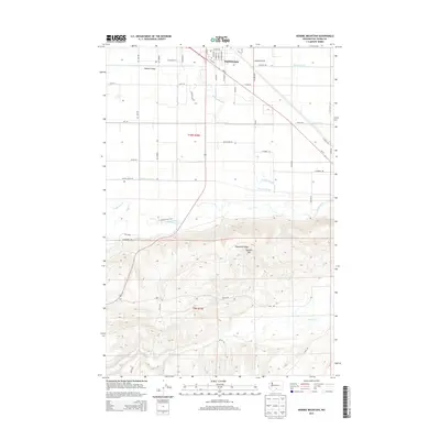
2011 McKays Butte
Yakima County, WA
2011 Medicine Valley
Yakima County, WA
2011 Meeks Table
Yakima County, WA
2011 Milk Canyon
Yakima County, WA
2011 Mount Adams East
Yakima County, WA
2011 Norse Peak
Yakima County, WA
2011 Old Scab Mountain
Yakima County, WA
2011 Outlet Falls
Yakima County, WA
2011 Pinegrass Ridge
Yakima County, WA
2011 Pine Mountain
Yakima County, WA
2011 Piscoe Meadow
Yakima County, WA
2011 Poisel Butte NW
Yakima County, WA
2011 Poisel Butte SE
Yakima County, WA
2011 Poisel Butte SW
Yakima County, WA
2011 Poisel Butte
Yakima County, WA
2011 Poland Butte
Yakima County, WA
2011 Pomona
Yakima County, WA
2011 Prosser SW
Yakima County, WA
2011 Raven Roost
Yakima County, WA

2011 Rimrock Lake
Yakima County, WA
2011 Selah Springs
Yakima County, WA
2011 Signal Peak
Yakima County, WA
2011 Spiral Butte
Yakima County, WA
2011 Stagman Butte
Yakima County, WA
2011 Sulphur Spring
Yakima County, WA
2011 The Cottonwoods
Yakima County, WA
2011 Tieton Basin
Yakima County, WA
2011 Timberwolf Mountain
Yakima County, WA
2011 Toppenish Mountain
Yakima County, WA
2011 Toppenish SW
Yakima County, WA
2011 Tule Prong
Yakima County, WA
2011 Twin Buttes
Yakima County, WA
2011 Weddle Canyon
Yakima County, WA
2011 Wenas Lake
Yakima County, WA

2011 Wiley City
Yakima County, WA
2011 Willy Dick Canyon
Yakima County, WA
2011 Windy Point
Yakima County, WA
2011 Yakima East
Yakima County, WA
2011 Yakima West
Yakima County, WA
2011 Yesmowit Canyon
Yakima County, WA
2013 Black Rock Spring NE
Yakima County, WA
2013 Black Rock Spring NW
Yakima County, WA
2013 Black Rock Spring SW
Yakima County, WA
2013 Black Rock Spring
Yakima County, WA
2013 Bluelight NW
Yakima County, WA
2013 Bluelight
Yakima County, WA
2013 Camas Patch
Yakima County, WA
2013 Elephant Mountain
Yakima County, WA
2013 Fort Simcoe
Yakima County, WA
2013 Granger NE
Yakima County, WA

2013 Granger NW
Yakima County, WA
2013 Hagerty Butte
Yakima County, WA
2013 Kusshi Creek
Yakima County, WA
2013 Logy Creek Falls
Yakima County, WA
2013 Logy Creek NE
Yakima County, WA
2013 Logy Creek SW
Yakima County, WA
2013 Mabton East
Yakima County, WA
2013 Mabton West
Yakima County, WA
2013 McKays Butte
Yakima County, WA
2013 Medicine Valley
Yakima County, WA
2013 Poisel Butte SE
Yakima County, WA
2013 Poisel Butte SW
Yakima County, WA
2013 Poisel Butte
Yakima County, WA
2013 Pomona
Yakima County, WA
2013 Prosser SW
Yakima County, WA
2013 Selah Springs
Yakima County, WA
2013 Stagman Butte
Yakima County, WA
2013 Sulphur Spring
Yakima County, WA

2013 The Cottonwoods
Yakima County, WA
2013 Toppenish Mountain
Yakima County, WA
2013 Tule Prong
Yakima County, WA
2013 Wenas Lake
Yakima County, WA
2013 Wiley City
Yakima County, WA
2013 Yakima East
Yakima County, WA
2013 Yakima West
Yakima County, WA
2013 Yesmowit Canyon
Yakima County, WA
2014 Bumping Lake
Yakima County, WA
2014 Cairn Hope Peak
Yakima County, WA
2014 Castile Falls
Yakima County, WA
2014 Cougar Lake
Yakima County, WA
2014 Darland Mountain
Yakima County, WA
2014 Fairview Ridge
Yakima County, WA
2014 Foundation Ridge
Yakima County, WA
2014 Glaciate Butte
Yakima County, WA
2014 Goose Prairie
Yakima County, WA
2014 Harrah SE
Yakima County, WA
2014 Jennies Butte
Yakima County, WA
2014 Jungle Butte
Yakima County, WA
2014 King Mountain
Yakima County, WA
2014 Kisumxi Mountain
Yakima County, WA
2014 Lost Horse Plateau
Yakima County, WA
2014 Meeks Table
Yakima County, WA
2014 Milk Canyon
Yakima County, WA
2014 Mount Adams East
Yakima County, WA
2014 Norse Peak
Yakima County, WA
2014 Old Scab Mountain
Yakima County, WA
2014 Outlet Falls
Yakima County, WA
2014 Pinegrass Ridge
Yakima County, WA
2014 Pine Mountain
Yakima County, WA
2014 Piscoe Meadow
Yakima County, WA
2014 Poisel Butte NW
Yakima County, WA
2014 Poland Butte
Yakima County, WA
2014 Raven Roost
Yakima County, WA
2014 Rimrock Lake
Yakima County, WA
2014 Signal Peak
Yakima County, WA
2014 Spiral Butte
Yakima County, WA
2014 Tieton Basin
Yakima County, WA
2014 Timberwolf Mountain
Yakima County, WA
2014 Toppenish SW
Yakima County, WA
2014 Twin Buttes
Yakima County, WA
2014 Weddle Canyon
Yakima County, WA
2014 Willy Dick Canyon
Yakima County, WA
2014 Windy Point
Yakima County, WA
2017 Black Rock Spring NE
Yakima County, WA
2017 Black Rock Spring NW
Yakima County, WA
2017 Black Rock Spring SW
Yakima County, WA
2017 Black Rock Spring
Yakima County, WA
2017 Bluelight NW
Yakima County, WA
2017 Bluelight
Yakima County, WA
2017 Bumping Lake
Yakima County, WA
2017 Cairn Hope Peak
Yakima County, WA
2017 Camas Patch
Yakima County, WA
2017 Castile Falls
Yakima County, WA
2017 Cougar Lake
Yakima County, WA
2017 Darland Mountain
Yakima County, WA
2017 Elephant Mountain
Yakima County, WA
2017 Fairview Ridge
Yakima County, WA
2017 Fort Simcoe
Yakima County, WA
2017 Foundation Ridge
Yakima County, WA
2017 Glaciate Butte
Yakima County, WA
2017 Goose Prairie
Yakima County, WA
2017 Granger NE
Yakima County, WA
2017 Granger NW
Yakima County, WA
2017 Hagerty Butte
Yakima County, WA
2017 Harrah SE
Yakima County, WA
2017 Jennies Butte
Yakima County, WA
2017 Jungle Butte
Yakima County, WA
2017 King Mountain
Yakima County, WA
2017 Kisumxi Mountain
Yakima County, WA
2017 Kusshi Creek
Yakima County, WA
2017 Logy Creek Falls
Yakima County, WA
2017 Logy Creek NE
Yakima County, WA
2017 Logy Creek SW
Yakima County, WA
2017 Lost Horse Plateau
Yakima County, WA
2017 Mabton East
Yakima County, WA
2017 Mabton West
Yakima County, WA
2017 McKays Butte
Yakima County, WA

2017 Medicine Valley
Yakima County, WA
2017 Meeks Table
Yakima County, WA
2017 Milk Canyon
Yakima County, WA
2017 Mount Adams East
Yakima County, WA
2017 Norse Peak
Yakima County, WA
2017 Old Scab Mountain
Yakima County, WA

2017 Outlet Falls
Yakima County, WA
2017 Pinegrass Ridge
Yakima County, WA
2017 Pine Mountain
Yakima County, WA
2017 Piscoe Meadow
Yakima County, WA
2017 Poisel Butte NW
Yakima County, WA
2017 Poisel Butte SE
Yakima County, WA
2017 Poisel Butte SW
Yakima County, WA
2017 Poisel Butte
Yakima County, WA
2017 Poland Butte
Yakima County, WA
2017 Pomona
Yakima County, WA
2017 Prosser SW
Yakima County, WA
2017 Raven Roost
Yakima County, WA
2017 Rimrock Lake
Yakima County, WA
2017 Selah Springs
Yakima County, WA
2017 Signal Peak
Yakima County, WA
2017 Spiral Butte
Yakima County, WA
2017 Stagman Butte
Yakima County, WA
2017 Sulphur Spring
Yakima County, WA
2017 The Cottonwoods
Yakima County, WA
2017 Tieton Basin
Yakima County, WA
2017 Timberwolf Mountain
Yakima County, WA
2017 Toppenish Mountain
Yakima County, WA
2017 Toppenish SW
Yakima County, WA
2017 Tule Prong
Yakima County, WA
2017 Twin Buttes
Yakima County, WA
2017 Weddle Canyon
Yakima County, WA
2017 Wenas Lake
Yakima County, WA
2017 Wiley City
Yakima County, WA
2017 Willy Dick Canyon
Yakima County, WA
2017 Windy Point
Yakima County, WA
2017 Yakima East
Yakima County, WA
2017 Yakima West
Yakima County, WA
2017 Yesmowit Canyon
Yakima County, WA
2020 Black Rock Spring NE
Yakima County, WA
2020 Black Rock Spring NW
Yakima County, WA
2020 Black Rock Spring SW
Yakima County, WA
2020 Black Rock Spring
Yakima County, WA
2020 Bluelight NW
Yakima County, WA
2020 Bluelight
Yakima County, WA
2020 Bumping Lake
Yakima County, WA
2020 Cairn Hope Peak
Yakima County, WA
2020 Camas Patch
Yakima County, WA
2020 Castile Falls
Yakima County, WA
2020 Cougar Lake
Yakima County, WA
2020 Darland Mountain
Yakima County, WA
2020 Elephant Mountain
Yakima County, WA
2020 Fairview Ridge
Yakima County, WA
2020 Fort Simcoe
Yakima County, WA
2020 Foundation Ridge
Yakima County, WA
2020 Glaciate Butte
Yakima County, WA
2020 Goose Prairie
Yakima County, WA
2020 Granger NE
Yakima County, WA
2020 Granger NW
Yakima County, WA
2020 Hagerty Butte
Yakima County, WA
2020 Harrah SE
Yakima County, WA
2020 Jennies Butte
Yakima County, WA
2020 Jungle Butte
Yakima County, WA
2020 King Mountain
Yakima County, WA
2020 Kisumxi Mountain
Yakima County, WA
2020 Kusshi Creek
Yakima County, WA
2020 Logy Creek Falls
Yakima County, WA

2020 Logy Creek NE
Yakima County, WA
2020 Logy Creek SW
Yakima County, WA
2020 Lost Horse Plateau
Yakima County, WA
2020 Mabton East
Yakima County, WA
2020 Mabton West
Yakima County, WA
2020 McKays Butte
Yakima County, WA
2020 Medicine Valley
Yakima County, WA
2020 Meeks Table
Yakima County, WA
2020 Milk Canyon
Yakima County, WA
2020 Mount Adams East
Yakima County, WA
2020 Norse Peak
Yakima County, WA
2020 Old Scab Mountain
Yakima County, WA
2020 Outlet Falls
Yakima County, WA
2020 Pinegrass Ridge
Yakima County, WA
2020 Pine Mountain
Yakima County, WA
2020 Piscoe Meadow
Yakima County, WA
2020 Poisel Butte NW
Yakima County, WA
2020 Poisel Butte SE
Yakima County, WA
2020 Poisel Butte SW
Yakima County, WA
2020 Poisel Butte
Yakima County, WA
2020 Poland Butte
Yakima County, WA
2020 Pomona
Yakima County, WA
2020 Prosser SW
Yakima County, WA
2020 Raven Roost
Yakima County, WA
2020 Rimrock Lake
Yakima County, WA
2020 Selah Springs
Yakima County, WA
2020 Signal Peak
Yakima County, WA
2020 Spiral Butte
Yakima County, WA
2020 Stagman Butte
Yakima County, WA
2020 Sulphur Spring
Yakima County, WA
2020 The Cottonwoods
Yakima County, WA

2020 Tieton Basin
Yakima County, WA
2020 Timberwolf Mountain
Yakima County, WA
2020 Toppenish Mountain
Yakima County, WA
2020 Toppenish SW
Yakima County, WA
2020 Tule Prong
Yakima County, WA
2020 Twin Buttes
Yakima County, WA
2020 Weddle Canyon
Yakima County, WA
2020 Wenas Lake
Yakima County, WA
2020 Wiley City
Yakima County, WA
2020 Willy Dick Canyon
Yakima County, WA
2020 Windy Point
Yakima County, WA
2020 Yakima East
Yakima County, WA
2020 Yakima West
Yakima County, WA
2020 Yesmowit Canyon
Yakima County, WA

2023 Black Rock Spring NE
Yakima County, WA

2023 Black Rock Spring NW
Yakima County, WA

2023 Black Rock Spring SW
Yakima County, WA

2023 Black Rock Spring
Yakima County, WA

2023 Bluelight NW
Yakima County, WA

2023 Bluelight
Yakima County, WA

2023 Bumping Lake
Yakima County, WA

2023 Cairn Hope Peak
Yakima County, WA

2023 Camas Patch
Yakima County, WA

2023 Castile Falls
Yakima County, WA

2023 Cougar Lake
Yakima County, WA

2023 Darland Mountain
Yakima County, WA

2023 Elephant Mountain
Yakima County, WA

2023 Fairview Ridge
Yakima County, WA

2023 Fort Simcoe
Yakima County, WA

2023 Foundation Ridge
Yakima County, WA

2023 Glaciate Butte
Yakima County, WA

2023 Goose Prairie
Yakima County, WA

2023 Granger NE
Yakima County, WA

2023 Granger NW
Yakima County, WA

2023 Hagerty Butte
Yakima County, WA

2023 Harrah SE
Yakima County, WA

2023 Jennies Butte
Yakima County, WA

2023 Jungle Butte
Yakima County, WA

2023 King Mountain
Yakima County, WA

2023 Kisumxi Mountain
Yakima County, WA

2023 Kusshi Creek
Yakima County, WA

2023 Logy Creek Falls
Yakima County, WA

2023 Logy Creek NE
Yakima County, WA

2023 Logy Creek SW
Yakima County, WA

2023 Lost Horse Plateau
Yakima County, WA

2023 Mabton East
Yakima County, WA

2023 Mabton West
Yakima County, WA

2023 McKays Butte
Yakima County, WA

2023 Medicine Valley
Yakima County, WA

2023 Meeks Table
Yakima County, WA

2023 Milk Canyon
Yakima County, WA

2023 Mount Adams East
Yakima County, WA

2023 Norse Peak
Yakima County, WA

2023 Old Scab Mountain
Yakima County, WA

2023 Outlet Falls
Yakima County, WA

2023 Pinegrass Ridge
Yakima County, WA

2023 Pine Mountain
Yakima County, WA

2023 Piscoe Meadow
Yakima County, WA

2023 Poisel Butte NW
Yakima County, WA

2023 Poisel Butte SE
Yakima County, WA

2023 Poisel Butte SW
Yakima County, WA

2023 Poisel Butte
Yakima County, WA

2023 Poland Butte
Yakima County, WA

2023 Pomona
Yakima County, WA

2023 Prosser SW
Yakima County, WA

2023 Raven Roost
Yakima County, WA

2023 Rimrock Lake
Yakima County, WA

2023 Selah Springs
Yakima County, WA

2023 Signal Peak
Yakima County, WA

2023 Spiral Butte
Yakima County, WA

2023 Stagman Butte
Yakima County, WA

2023 Sulphur Spring
Yakima County, WA

2023 The Cottonwoods
Yakima County, WA

2023 Tieton Basin
Yakima County, WA

2023 Timberwolf Mountain
Yakima County, WA

2023 Toppenish Mountain
Yakima County, WA

2023 Toppenish SW
Yakima County, WA

2023 Tule Prong
Yakima County, WA

2023 Twin Buttes
Yakima County, WA

2023 Weddle Canyon
Yakima County, WA

2023 Wenas Lake
Yakima County, WA

2023 Wiley City
Yakima County, WA

2023 Willy Dick Canyon
Yakima County, WA

2023 Windy Point
Yakima County, WA

2023 Yakima East
Yakima County, WA

2023 Yakima West
Yakima County, WA

2023 Yesmowit Canyon
Yakima County, WA